IMAGES TAKEN NEAR TO
Stubbs Lane, BRAINTREE, CM7 3XB
Introduction
This page details the photographs taken nearby to Stubbs Lane, CM7 3XB by members of the Geograph project.
The Geograph project started in 2005 with the aim of publishing, organising and preserving representative images for every square kilometre of Great Britain, Ireland and the Isle of Man.

There are currently over 7.5m images from over14,400 individuals and you can help contribute to the project by visiting https://www.geograph.org.uk
Image Map (Loading...)


Getting Data...Please wait
Leaflet Map data © OpenStreetMap
Images are licensed for reuse under creativecommons.org/licenses/by-sa/2.0
Notes
- Clicking on the map will re-center to the selected point.
- The higher the marker number, the further away the image location is from the centre of the postcode.
Image Listing (9 Images Found)
Images are licensed for reuse under creativecommons.org/licenses/by-sa/2.0
Image
Details
Distance
1

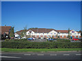
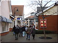
Braintree Rugby Club
This aspect of the clubhouse faces east. There is a game of rugby in progress and these spectators are on the balcony of the upstairs bar.
Image: © Brenda Howard
Taken: 17 Sep 2005
0.16 miles
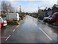
3

Traffic lights on Cressing Road, Braintree
Image: © nick macneill
Taken: 29 Jun 2011
0.21 miles
4
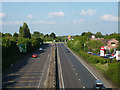
A120 looking east
The B1018 roundabout is ahead. Viewed from the B1018, Millennium Way bridge.
Image: © Robin Webster
Taken: 27 May 2013
0.22 miles
5
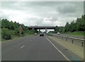
A120 overbridge carries Millennium Way
Image: © Stuart Logan
Taken: 23 Jun 2013
0.23 miles
9
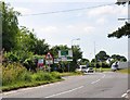
Long Green towards the A120 roundabout
Side road leading to the busy main road near Tye Green, Braintree
Image: © MJ Reilly
Taken: 12 Jun 2009
0.25 miles