IMAGES TAKEN NEAR TO
Warren Road, BRAINTREE, CM7 3PB
Introduction
This page details the photographs taken nearby to Warren Road, CM7 3PB by members of the Geograph project.
The Geograph project started in 2005 with the aim of publishing, organising and preserving representative images for every square kilometre of Great Britain, Ireland and the Isle of Man.

There are currently over 7.5m images from over14,400 individuals and you can help contribute to the project by visiting https://www.geograph.org.uk
Image Map (Loading...)


Getting Data...Please wait
Leaflet Map data © OpenStreetMap
Images are licensed for reuse under creativecommons.org/licenses/by-sa/2.0
Notes
- Clicking on the map will re-center to the selected point.
- The higher the marker number, the further away the image location is from the centre of the postcode.
Image Listing (30 Images Found)
Images are licensed for reuse under creativecommons.org/licenses/by-sa/2.0
Image
Details
Distance
2
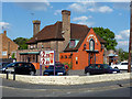
The Orange Tree, Braintree
If maps have it right, this is a product of the 1950s.
Image: © Robin Webster
Taken: 27 May 2013
0.09 miles
3
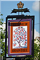
The Orange Tree - inn sign
Unusually, the pub name is not given (it is on the building), but instead a sort of slogan.
Image: © Robin Webster
Taken: 27 May 2013
0.11 miles
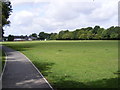
4
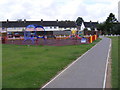
Children's Play area at King Georges Playing Field
Image: © Geographer
Taken: 2 Aug 2009
0.14 miles
5
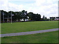
Rugby Field at King Georges Playing Field
Image: © Geographer
Taken: 2 Aug 2009
0.14 miles
6
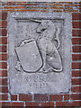
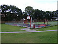
Plaque at the entrance to King Georges Playing Field
Off the B1018 Cressing Road
Image: © Geographer
Taken: 2 Aug 2009
0.14 miles
7
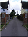
Entrance to King Georges Playing Field
Off the B1018 Cressing Road
Image: © Geographer
Taken: 2 Aug 2009
0.15 miles
9
Children's Play area at King Georges Playing Field
Image: © Geographer
Taken: 2 Aug 2009
0.15 miles
10
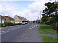
B1018 Cressing Road
Looking towards Braintree at the junction with Stubbs Lane
Image: © Geographer
Taken: 2 Aug 2009
0.16 miles