IMAGES TAKEN NEAR TO
Brick Kiln Way, BRAINTREE, CM7 3FP
Introduction
This page details the photographs taken nearby to Brick Kiln Way, CM7 3FP by members of the Geograph project.
The Geograph project started in 2005 with the aim of publishing, organising and preserving representative images for every square kilometre of Great Britain, Ireland and the Isle of Man.

There are currently over 7.5m images from over14,400 individuals and you can help contribute to the project by visiting https://www.geograph.org.uk
Image Map (Loading...)


Getting Data...Please wait
Leaflet Map data © OpenStreetMap
Images are licensed for reuse under creativecommons.org/licenses/by-sa/2.0
Notes
- Clicking on the map will re-center to the selected point.
- The higher the marker number, the further away the image location is from the centre of the postcode.
Image Listing (15 Images Found)
Images are licensed for reuse under creativecommons.org/licenses/by-sa/2.0
Image
Details
Distance

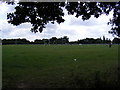
3
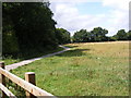
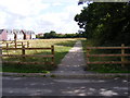
Path to Martens Meadow
Near to the Braintree Rugby Union Club
Image: © Geographer
Taken: 2 Aug 2009
0.15 miles
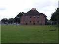
4
Braintree Rugby Union Football Club Ground
Image: © Geographer
Taken: 2 Aug 2009
0.15 miles
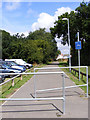
6
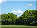
Through the layby hedge
A buzzard ascends on high, having been perched in a tree until disturbed by my appearance.
Image: © Robin Webster
Taken: 27 May 2013
0.17 miles
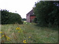
8
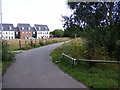
Path to Dunstable Drive
Near Braintree Rugby Ground
Image: © Geographer
Taken: 2 Aug 2009
0.18 miles
10

Dried up Pond near King Georges Playing Field
Image: © Geographer
Taken: 2 Aug 2009
0.20 miles