1
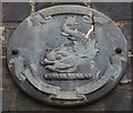
Braintree old fire station
Braintree old fire station, Swan Side, Braintree, Essex, which is being converted into flats
Image: © Kevin Hale
Taken: 5 Jun 2010
0.04 miles
2
Three Steven Sykes Sculptured Panels, Sainsbury's, Drury Lane, Braintree
When Sainsbury's were planning their new Braintree supermarket on the site of the former Tofts Garage in the early 1980's, they commissioned eight sculptured wall panels from the late Steven Sykes (1914-99) http://www.independent.co.uk/arts-entertainment/obituary-steven-sykes-1072852.html.
They were carved in moulds of clay, and then cast with a special fine concrete. Each was divided so that it could be lifted and fixed and then coated with special resins to colour and protect them.
Braintree is in the heart of land producing Food and Drink, the theme of these three panels which can be seen in more detail with a description of the content here:
Image
Image
Image
Image: © Trevor Wright
Taken: 23 Jul 2009
0.06 miles
3
Steven Sykes Sculptured Panel, Corn and Bread, Sainsbury's, Drury Lane, Braintree
One of three panels in the Drury Lane "Food and Drink" group, Corn and Bread are shown being produced and baked. The windmill still stands in Bocking and although the figures are 14th century many details in the pictures can still be found today. Look for rabbits in the cornfield, and cottage loaves in the bakery.
For the background to these panels and the other two in the Drury Lane group, see here:
Image
Image
Image
And for two views of the Bocking Windmill by Brenda Howard see:
Image
Image
Image: © Trevor Wright
Taken: 23 Jul 2009
0.06 miles
4
Steven Sykes Sculptured Panel, Brewhouse, Sainsbury's, Drury Lane, Braintree
One of three panels in the Drury Lane "Food and Drink" group, hops and strong beer were the pride of Braintree and maltings and oast houses were found all round the town. The church fields and oast houses all appear in an 1832 engraving from the Notley Road. The large Brewhouse shows the beer being stirred with large paddles and dates from 1764. Can you see the cats and mice brewing their own beer?
For the background to these panels and the other two in the Drury Lane group, see here:
Image
Image
Image
Image: © Trevor Wright
Taken: 23 Jul 2009
0.06 miles
5
Steven Sykes Sculptured Panel, Cattle Market/Inns/Butcher, Sainsbury's, Drury Lane, Braintree
One of three panels in the Drury Lane "Food and Drink" group, many people in Braintree will remember the Cattle Markets in Great Square and Fairfield, with stalls for farmers wives to sell fowls, eggs, butter and cheese between the pens. Round the noisy market were the Inns some of which still stand today. Below is a typical "Family Butcher" proudly displaying home killed meat, game and home cooked sausage, ham and pies.
For the background to these panels and the other two in the Drury Lane group, see here:
Image
Image
Image
Image: © Trevor Wright
Taken: 23 Jul 2009
0.06 miles
6
"The Swan" public house, Braintree
Image: © Jim Osley
Taken: 6 May 2017
0.06 miles
7
Old Boundary Marker by the B1258, Bocking End, Braintree
Parish Boundary Marker by the B1258, in parish of Braintree (Braintree District), on the offices of Holmes & Hills, Solicitors, Dale Chambers, Bocking End, Bocking. The boundary marker is above the door of the C19th extension adjacent to the White Hart Hotel.
#2 Bocking End is Grade II Listed. List Entry Number:1122540
https://historicengland.org.uk/listing/the-list/list-entry/1122540
Surveyed
Milestone Society National ID: EX_BOCK01pb
Image: © Milestone Society
Taken: Unknown
0.07 miles
8
Coggeshall Road
From
Image, looking towards the town centre.
Image: © Hamish Griffin
Taken: 30 Nov 2014
0.08 miles
9
Braintree music
See https://www.youtube.com/watch?v=wFPr7p6jkZ4 for a video.
Image: © Hamish Griffin
Taken: 30 Nov 2014
0.09 miles
10
Bank Street
From Swan Side junction.
Image: © Hamish Griffin
Taken: 30 Nov 2014
0.09 miles


