IMAGES TAKEN NEAR TO
Boyton End, DUNMOW, CM6 2RB
Introduction
This page details the photographs taken nearby to Boyton End, CM6 2RB by members of the Geograph project.
The Geograph project started in 2005 with the aim of publishing, organising and preserving representative images for every square kilometre of Great Britain, Ireland and the Isle of Man.

There are currently over 7.5m images from over14,400 individuals and you can help contribute to the project by visiting https://www.geograph.org.uk
Image Map
Images are licensed for reuse under creativecommons.org/licenses/by-sa/2.0
Notes
- Clicking on the map will re-center to the selected point.
- The higher the marker number, the further away the image location is from the centre of the postcode.
Image Listing (3 Images Found)
Images are licensed for reuse under creativecommons.org/licenses/by-sa/2.0
Image
Details
Distance
1
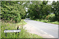
Road sign
Boynton End consists of just a few houses
Image: © Richard Dear
Taken: 6 Jul 2007
0.15 miles
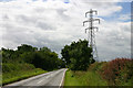
2
B1051 towards Great Sampford
The track to some of Boyton End is ahead on the left.
Image: © Robin Webster
Taken: 3 Jun 2018
0.15 miles