IMAGES TAKEN NEAR TO
St. Michaels Mews, Chelmsford Road, DUNMOW, CM6 1QZ
Introduction
This page details the photographs taken nearby to St. Michaels Mews, Chelmsford Road, CM6 1QZ by members of the Geograph project.
The Geograph project started in 2005 with the aim of publishing, organising and preserving representative images for every square kilometre of Great Britain, Ireland and the Isle of Man.

There are currently over 7.5m images from over14,400 individuals and you can help contribute to the project by visiting https://www.geograph.org.uk
Image Map
Images are licensed for reuse under creativecommons.org/licenses/by-sa/2.0
Notes
- Clicking on the map will re-center to the selected point.
- The higher the marker number, the further away the image location is from the centre of the postcode.
Image Listing (14 Images Found)
Images are licensed for reuse under creativecommons.org/licenses/by-sa/2.0
Image
Details
Distance
2
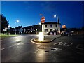
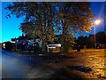
Chelmsford Road at the junction of High Easter Road
Image: © David Howard
Taken: 31 Oct 2021
0.10 miles
5
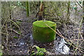
WW2 Spigot Mortar Emplacement
This Spigot Mortar Emplacement is hidden in a hedge in Leaden Roding. It is one of 3 within about 150 yards. The stainless steel spigot on the top is in perfect condition hard to believe it's been there 70 years. I was told by a local, who has one in his garden, that there are others nearby. They were for WW2 Home Guard use.
Image: © Arthur Stevens
Taken: 28 Jan 2013
0.13 miles
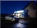
6
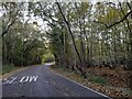
High Easter Road at the junction of Lordswood View
Image: © David Howard
Taken: 31 Oct 2021
0.14 miles
7
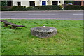
WW2 Spigot Mortar Emplacement
This Spigot Mortar Emplacement is just beside the B184 road, Leaden Roding. It is one of 3 within about 150 yards, There is only around 18 inches showing above ground it has been filled in and levelled over the years. The stainless steel spigot on the top is in perfect condition hard to believe it's been there 70 years. I was told by a local, who has one in his garden, that there are others nearby. They were for WW2 Home Guard use.
Image: © Arthur Stevens
Taken: 28 Jan 2013
0.15 miles
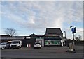
9

The approach to Leaden Roding on High Easter Road
Image: © Robert Edwards
Taken: 14 Apr 2008
0.17 miles
10
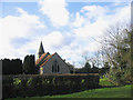
Parish Church, Leaden Roding, Essex
The church of St Michael and All Angels - the nave and chancel are Norman and the belfry dates to 15th century
Image: © John Winfield
Taken: 20 Jan 2006
0.20 miles