IMAGES TAKEN NEAR TO
Bennet Canfield, DUNMOW, CM6 1HE
Introduction
This page details the photographs taken nearby to Bennet Canfield, CM6 1HE by members of the Geograph project.
The Geograph project started in 2005 with the aim of publishing, organising and preserving representative images for every square kilometre of Great Britain, Ireland and the Isle of Man.

There are currently over 7.5m images from over14,400 individuals and you can help contribute to the project by visiting https://www.geograph.org.uk
Image Map
Images are licensed for reuse under creativecommons.org/licenses/by-sa/2.0
Notes
- Clicking on the map will re-center to the selected point.
- The higher the marker number, the further away the image location is from the centre of the postcode.
Image Listing (11 Images Found)
Images are licensed for reuse under creativecommons.org/licenses/by-sa/2.0
Image
Details
Distance
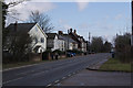
2
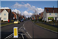
Houses on Stortford Road, Little Canfield
Image: © David Howard
Taken: 19 Nov 2017
0.21 miles
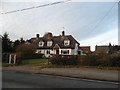
3
Houses on Stortford Road, Little Canfield
Image: © David Howard
Taken: 19 Nov 2017
0.21 miles
4
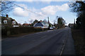
Dunmow Road
Looking east towards the new housing development at Priors Green.
Image: © Thomas Nugent
Taken: 10 Feb 2010
0.22 miles
5
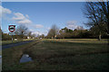
Field at Smiths Green Road
At the corner of Dunmow Road.
Image: © Thomas Nugent
Taken: 10 Feb 2010
0.22 miles
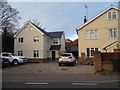
6
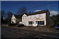
Disused business premises
With serious looking antennae, On Dunmow Road.
Image: © Thomas Nugent
Taken: 10 Feb 2010
0.22 miles
7
Warwick Road
Despite the recession, business is apparently booming.
Image: © Thomas Nugent
Taken: 10 Feb 2010
0.22 miles
8
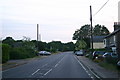
Dunmow Road
Dunmow Road (B1256) heading to Takeley
Image: © Shaun Ferguson
Taken: 30 Jun 2010
0.22 miles
9

Post box on Dunmow Road
Near to Smiths Green Road.
Image: © Thomas Nugent
Taken: 10 Feb 2010
0.23 miles
10
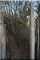
Public footpath
Leading north off Dunmow Road at Priors Green.
Image: © Thomas Nugent
Taken: 10 Feb 2010
0.23 miles