IMAGES TAKEN NEAR TO
Epping Road, ONGAR, CM5 0DE
Introduction
This page details the photographs taken nearby to Epping Road, CM5 0DE by members of the Geograph project.
The Geograph project started in 2005 with the aim of publishing, organising and preserving representative images for every square kilometre of Great Britain, Ireland and the Isle of Man.

There are currently over 7.5m images from over14,400 individuals and you can help contribute to the project by visiting https://www.geograph.org.uk
Image Map
Images are licensed for reuse under creativecommons.org/licenses/by-sa/2.0
Notes
- Clicking on the map will re-center to the selected point.
- The higher the marker number, the further away the image location is from the centre of the postcode.
Image Listing (4 Images Found)
Images are licensed for reuse under creativecommons.org/licenses/by-sa/2.0
Image
Details
Distance

2
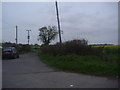
Penson's Lane, High Ongar
Providing access to New Barns cottages over the old railway line now used for the Epping-Ongar Railway (which only goes to North Weald).
Image: © David Howard
Taken: 2 May 2012
0.22 miles
4
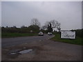
Epping Road at the junction of Penson's Lane
The advert is for the Vojan restaurant to the right of the shot
Image: © David Howard
Taken: 2 May 2012
0.22 miles