IMAGES TAKEN NEAR TO
Slough Lane, CHELMSFORD, CM3 6RA
Introduction
This page details the photographs taken nearby to Slough Lane, CM3 6RA by members of the Geograph project.
The Geograph project started in 2005 with the aim of publishing, organising and preserving representative images for every square kilometre of Great Britain, Ireland and the Isle of Man.

There are currently over 7.5m images from over14,400 individuals and you can help contribute to the project by visiting https://www.geograph.org.uk
Image Map
Images are licensed for reuse under creativecommons.org/licenses/by-sa/2.0
Notes
- Clicking on the map will re-center to the selected point.
- The higher the marker number, the further away the image location is from the centre of the postcode.
Image Listing (6 Images Found)
Images are licensed for reuse under creativecommons.org/licenses/by-sa/2.0
Image
Details
Distance
1
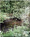
Pond, Cock Clarks
At junction of Slough Lane and Marlpits Road.
Image: © John Myers
Taken: 1 Sep 2006
0.03 miles
2
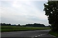
Road junction near Cock Clarks
Looking down Hackmans Lane towards Cock Clarks from the end of Slough Lane.
Image: © Trevor Harris
Taken: 9 Jun 2014
0.07 miles
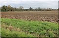
3
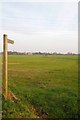
Part of Slough Lane
The footpath on the right goes to Cock Clarks.
Image: © Robert Edwards
Taken: 5 Mar 2008
0.08 miles
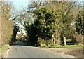
4
Footpath to Cock Clarks
This path leads to Hackman's Lane north west of Cock Clarks
Image: © Glyn Baker
Taken: 28 Mar 2014
0.10 miles
5
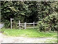
Footpath off Slough Road, Bicknacre
Stile at entrance to a rather gloomy footpath flanked by dense hedgerows.
Image: © John Myers
Taken: 1 Sep 2006
0.11 miles