IMAGES TAKEN NEAR TO
Church Road, CHELMSFORD, CM3 3FA
Introduction
This page details the photographs taken nearby to Church Road, CM3 3FA by members of the Geograph project.
The Geograph project started in 2005 with the aim of publishing, organising and preserving representative images for every square kilometre of Great Britain, Ireland and the Isle of Man.

There are currently over 7.5m images from over14,400 individuals and you can help contribute to the project by visiting https://www.geograph.org.uk
Image Map
Images are licensed for reuse under creativecommons.org/licenses/by-sa/2.0
Notes
- Clicking on the map will re-center to the selected point.
- The higher the marker number, the further away the image location is from the centre of the postcode.
Image Listing (5 Images Found)
Images are licensed for reuse under creativecommons.org/licenses/by-sa/2.0
Image
Details
Distance
1
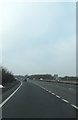
A12 Ipswich Road, Boreham
Approaching the junction with the A130 & B1337
Image: © Geographer
Taken: 15 Feb 2015
0.14 miles
5
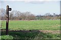
Pointless Fingerpost
Why would anyone want to traipse 150m across a field as far as the A12 and back?
Image: © Glyn Baker
Taken: 12 Mar 2020
0.20 miles