IMAGES TAKEN NEAR TO
Hornells Corner, CHELMSFORD, CM3 1QW
Introduction
This page details the photographs taken nearby to Hornells Corner, CM3 1QW by members of the Geograph project.
The Geograph project started in 2005 with the aim of publishing, organising and preserving representative images for every square kilometre of Great Britain, Ireland and the Isle of Man.

There are currently over 7.5m images from over14,400 individuals and you can help contribute to the project by visiting https://www.geograph.org.uk
Image Map
Images are licensed for reuse under creativecommons.org/licenses/by-sa/2.0
Notes
- Clicking on the map will re-center to the selected point.
- The higher the marker number, the further away the image location is from the centre of the postcode.
Image Listing (6 Images Found)
Images are licensed for reuse under creativecommons.org/licenses/by-sa/2.0
Image
Details
Distance
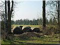
2
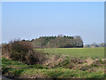
View towards plantation north of Hornells Corner
Image: © Robin Webster
Taken: 5 Mar 2013
0.13 miles
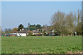
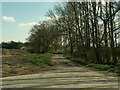
3
Trees along Felsted Road
Willow Lodge is the house in the distance.
Image: © Robin Webster
Taken: 5 Mar 2013
0.16 miles
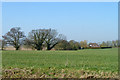
4
Blocked field entrance
Presumably one of the fields of Dumney Lane Farm.
Image: © Robin Webster
Taken: 5 Mar 2013
0.17 miles
5
Dumney Lane
This lane leads to Dumney Lane Farm only.
Image: © Robert Edwards
Taken: 9 Apr 2007
0.22 miles