IMAGES TAKEN NEAR TO
West Hanningfield Road, CHELMSFORD, CM2 8FR
Introduction
This page details the photographs taken nearby to West Hanningfield Road, CM2 8FR by members of the Geograph project.
The Geograph project started in 2005 with the aim of publishing, organising and preserving representative images for every square kilometre of Great Britain, Ireland and the Isle of Man.

There are currently over 7.5m images from over14,400 individuals and you can help contribute to the project by visiting https://www.geograph.org.uk
Image Map
Images are licensed for reuse under creativecommons.org/licenses/by-sa/2.0
Notes
- Clicking on the map will re-center to the selected point.
- The higher the marker number, the further away the image location is from the centre of the postcode.
Image Listing (18 Images Found)
Images are licensed for reuse under creativecommons.org/licenses/by-sa/2.0
Image
Details
Distance
1
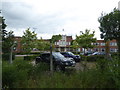
Old factory buildings at Great Baddow, Essex
Impressive 1930's style office buildings.
Image: © Jeremy Bolwell
Taken: 16 Jun 2018
0.06 miles
2
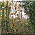
Interior of small woodland near Vicarage Lane, Great Baddow
Image: © Roger Jones
Taken: 28 Feb 2016
0.06 miles
3
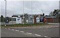
Research laboratories by West Hanningfield Road, Great Baddow
Image: © David Howard
Taken: 12 Mar 2023
0.07 miles
4
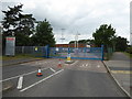
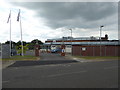
Industrial estate gates at Great Baddow, Essex
It looks like it was once a factory or unified premises but is now named Chlemsford Office & Technology Park and comprises a variety of construction, cleaning and heating companies, like any business park might.
Image: © Jeremy Bolwell
Taken: 16 Jun 2018
0.08 miles
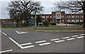
5
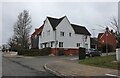
Part of Great Baddow Hospital
Nice premises.
Image: © Jeremy Bolwell
Taken: 16 Jun 2018
0.09 miles
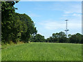
7
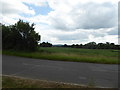
View across fields near Great Baddow, Essex
Distant view to a spire and mast.
Image: © Jeremy Bolwell
Taken: 16 Jun 2018
0.11 miles
8
Eastwood Park from West Hanningfield Road
Image: © David Howard
Taken: 12 Mar 2023
0.12 miles
9
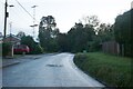
Vicarage Lane, Great Baddow
This is the end of the built up part of Chelmsford.
Image: © David Howard
Taken: 29 Oct 2023
0.18 miles
10
Radar tower, Great Baddow
One of the many transmitter towers of the 'Chain Home' WWII defensive radar system erected mainly along the eastern coasts, and the only one to survive more or less intact. It was originally installed at Canewdon, and moved here in 1953, after the system became outmoded, to further Marconi's radar and radio research. It is steel, the receiver towers were wood, and none survive.
Image: © Robin Webster
Taken: 22 Jul 2012
0.19 miles