1
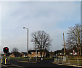
Chelmsford: Sandford Road
Image: © Christopher Hilton
Taken: 15 Oct 2018
0.06 miles
2
Houses on Sandford Road
Is the crime rate any better in this area, with the Essex Police headquarters close by?
Image: © Robin Webster
Taken: 15 Sep 2011
0.09 miles
3
Springfield Park Baptist Church Chelmsford Essex
Situated in Springfield Park Road, Springfield, Chelmsford.
Image: © Peter Stack
Taken: 26 Jan 2008
0.13 miles
4
Old Boundary Marker on Sanford Road, Chelmsford
Prison Commission Boundary Marker set in the front garden wall of No. 32 on the south side of Sandford Road, Chelmsford. Marking the northeast boundary of Chelmsford Prison.
Milestone Society National ID: EX_PCCHEL15Bem
Image: © M Bardell
Taken: 16 Mar 2022
0.14 miles
5
Old Boundary Marker on Sanford Road, Chelmsford
Prison Commission Boundary Marker set in the front garden wall of No. 26 on the south side of Sandford Road, Chelmsford. Marking the northeast boundary of Chelmsford Prison.
Milestone Society National ID: EX_PCCHEL17em
Image: © M Bardell
Taken: 16 Mar 2022
0.15 miles
6
Old Boundary Marker on Sanford Road, Chelmsford
Prison Commission Boundary Marker set in the midpoint of the front garden wall between Nos. 24 and 26 on the south side of Sandford Road, Chelmsford. Marking the northeast boundary of Chelmsford Prison.
Milestone Society National ID: EX_PCCHEL18em
Image: © M Bardell
Taken: 16 Mar 2022
0.16 miles
7
Sandford Road, Chelmsford
At the junction with the A138 Chelmer Road
Image: © Geographer
Taken: 15 Feb 2015
0.16 miles
8
A138 Chelmer Road, Chelmsford
At the junction with Sandford Road
Image: © Geographer
Taken: 15 Feb 2015
0.17 miles
9
A138 Chelmer Road, Chelmsford
At the junction with Sandford Road
Image: © Geographer
Taken: 15 Feb 2015
0.17 miles
10
Old Boundary Marker on Sanford Road, Chelmsford
Prison Commission Boundary Marker against a struggling wooden fence fencing off a grass triangle at the foot of the prison wall on the south side of Sandford Road, Chelmsford. Marking the northeast boundary of Chelmsford Prison.
Milestone Society National ID: EX_PCCHEL19em
Image: © M Bardell
Taken: 16 Mar 2022
0.25 miles


