IMAGES TAKEN NEAR TO
Cambridge Walk, BISHOP'S STORTFORD, CM22 6UE
Introduction
This page details the photographs taken nearby to Cambridge Walk, CM22 6UE by members of the Geograph project.
The Geograph project started in 2005 with the aim of publishing, organising and preserving representative images for every square kilometre of Great Britain, Ireland and the Isle of Man.

There are currently over 7.5m images from over14,400 individuals and you can help contribute to the project by visiting https://www.geograph.org.uk
Image Map
Images are licensed for reuse under creativecommons.org/licenses/by-sa/2.0
Notes
- Clicking on the map will re-center to the selected point.
- The higher the marker number, the further away the image location is from the centre of the postcode.
Image Listing (39 Images Found)
Images are licensed for reuse under creativecommons.org/licenses/by-sa/2.0
Image
Details
Distance
1
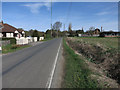
Site of former level crossing, Elsenham
The hump in the road and what appears to be a concrete gate post on the right marks the spot. This was for the connection to the Thaxted branch, closed in 1953. Oddly, this link with the main line trailed in towards Cambridge, yet passenger services reached Elsenham station facing towards London. There was no physical link at Elsenham station between branch and main line.
Image: © Robin Webster
Taken: 16 Mar 2014
0.01 miles
2
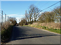
Old gatepost for Thaxted branch goods spur level crossing
The line crossed the road at an acute angle, just how the gates were arranged I have been unable to find out. This position only makes sense for it to be the latch end of the gate when closed to the railway on the Thaxted side of the road.
Image: © Robin Webster
Taken: 16 Mar 2014
0.02 miles
4
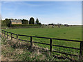
Horses by Old Mead Road
A planning notice showed that this area may soon be part of a significant expansion of Elsenham.
Image: © Hugh Venables
Taken: 12 Apr 2015
0.04 miles
5
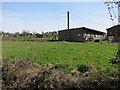
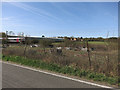
Former poultry farm
Now horses and it may soon be housing if the planning notice gets the go ahead.
Image: © Hugh Venables
Taken: 12 Apr 2015
0.07 miles
7
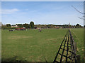
Horse paddocks near Elsenham
There were planning notices due to plans to build a significant expansion of Elsenham.
Image: © Hugh Venables
Taken: 12 Apr 2015
0.08 miles
8
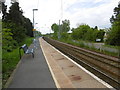
The down platform at Elsenham station
The railway line to Cambridge was opened by the Eastern Counties Railway on 30th July 1845 at which date Elsenham station also opened. The station has staggered platforms on either side of the level crossing so that trains pass over the crossing before stopping at the station.
This view is the down platform. The up platform is behind, beyond the level crossing - see http://www.geograph.org.uk/photo/4950232
Image: © Marathon
Taken: 14 May 2016
0.09 miles
9
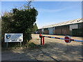
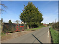
Tuplin global packing and logistics
On the edge of Elsenham.
Image: © Hugh Venables
Taken: 12 Apr 2015
0.10 miles