IMAGES TAKEN NEAR TO
Bush End, BISHOP'S STORTFORD, CM22 6NF
Introduction
This page details the photographs taken nearby to Bush End, CM22 6NF by members of the Geograph project.
The Geograph project started in 2005 with the aim of publishing, organising and preserving representative images for every square kilometre of Great Britain, Ireland and the Isle of Man.

There are currently over 7.5m images from over14,400 individuals and you can help contribute to the project by visiting https://www.geograph.org.uk
Image Map
Images are licensed for reuse under creativecommons.org/licenses/by-sa/2.0
Notes
- Clicking on the map will re-center to the selected point.
- The higher the marker number, the further away the image location is from the centre of the postcode.
Image Listing (25 Images Found)
Images are licensed for reuse under creativecommons.org/licenses/by-sa/2.0
Image
Details
Distance
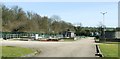
1
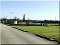
Sewage treatment works
At Takeley Street, just south of the old railway line. See also Image
Image: © Thomas Nugent
Taken: 16 Mar 2007
0.07 miles
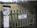
2
Entrance to Hatfield Park
Hatfield Park Farm also has a golf course.
Image: © PAUL FARMER
Taken: 17 Feb 2009
0.07 miles
3
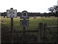
Signs at minor entrance to Hatfield Forest
Image: © PAUL FARMER
Taken: 17 Feb 2009
0.08 miles
5
Sewage treatment works
South of the old railway line (which is within the trees on the left) in Takeley Street.
Image: © Thomas Nugent
Taken: 16 Mar 2007
0.09 miles
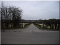
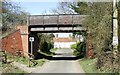
6
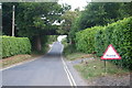
No Flood Today
No flood today on the road down to Hatfield Forest as it passes under the old railway bridge
Image: © Shaun Ferguson
Taken: 30 Jun 2010
0.09 miles
7
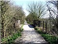
Footpath at Takeley Street
On the old railway line where it crosses a minor road near the sewage works. See also Image
Image: © Thomas Nugent
Taken: 16 Mar 2007
0.10 miles
8
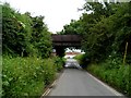
Railway bridge over disused railway
The Bishop's Stortford, Dunmow and Braintree Railway opened in 1869. It closed to passengers in 1961(although regular services stopped in 1952). It closed to goods in and is now a cyclepath/footpath.
Image: © Bikeboy
Taken: 7 Jun 2014
0.10 miles
9
Old railway bridge
At Takeley Street. Now carries a footpath/cycle path. Note the anti-Stansted Airport expansion poster of which there are several in the area.
Image: © Thomas Nugent
Taken: 16 Mar 2007
0.10 miles
10
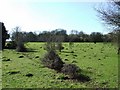
Anthills in a field
In a field just south of the old railway line footpath, near the sewage works.
Image: © Thomas Nugent
Taken: 16 Mar 2007
0.11 miles