IMAGES TAKEN NEAR TO
School Lane, HARLOW, CM20 2QE
Introduction
This page details the photographs taken nearby to School Lane, CM20 2QE by members of the Geograph project.
The Geograph project started in 2005 with the aim of publishing, organising and preserving representative images for every square kilometre of Great Britain, Ireland and the Isle of Man.

There are currently over 7.5m images from over14,400 individuals and you can help contribute to the project by visiting https://www.geograph.org.uk
Image Map
Images are licensed for reuse under creativecommons.org/licenses/by-sa/2.0
Notes
- Clicking on the map will re-center to the selected point.
- The higher the marker number, the further away the image location is from the centre of the postcode.
Image Listing (63 Images Found)
Images are licensed for reuse under creativecommons.org/licenses/by-sa/2.0
Image
Details
Distance
1
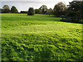
Green on former pitch and putt
Sited in Harlow Town park.
Image: © Roger McLachlan
Taken: 21 Oct 2006
0.08 miles

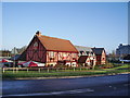
4
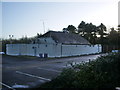
Burnt Mill Snooker & Social Club, Harlow
Image: © Alexander P Kapp
Taken: 28 Dec 2007
0.09 miles
5
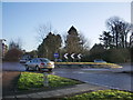
Roundabout on Edinburgh Gate, Harlow
Image: © Alexander P Kapp
Taken: 28 Dec 2007
0.09 miles
6
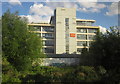
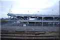
Pearson Education, Harlow
The headquarters building of the publishing firm at Edinburgh Gate, seen from a train on the line from Sawbridgeworth to Harlow.
Image: © Derek Harper
Taken: 2 Aug 2012
0.10 miles
7
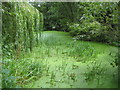
Harlow: Marshgate Spring Local Nature Reserve
Duckweed has colonized all of the surface water area of this pond in the nature reserve. Spot the heron!
Image: © Nigel Cox
Taken: 26 Aug 2009
0.12 miles
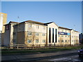
8
Toby Carvery, Edinburgh Gate, Harlow
Image: © Alexander P Kapp
Taken: 28 Dec 2007
0.14 miles
10
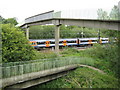
Harlow: Railway footbridge
This high and slender concrete footbridge over the railway is about 400 metres east of Harlow Town station, and is approached by a V-shaped ramp on either side. It follows the route of a right of way that existed before the railway was built, between the town and the canal. An airport-bound Stansted Express train hurtles by underneath. Although the train is a franchise operated by National Express, is not the livery a hint in the direction of EasyJet?
Image: © Nigel Cox
Taken: 26 Aug 2009
0.16 miles