IMAGES TAKEN NEAR TO
Canons Brook, HARLOW, CM19 4EG

Introduction

This page details the photographs taken nearby to Canons Brook, CM19 4EG by members of the Geograph project.

The Geograph project started in 2005 with the aim of publishing, organising and preserving representative images for every square kilometre of Great Britain, Ireland and the Isle of Man.

There are currently over 7.5m images from over14,400 individuals and you can help contribute to the project by visiting https://www.geograph.org.uk

Image Map


Images are licensed for reuse under creativecommons.org/licenses/by-sa/2.0
Notes
  • Clicking on the map will re-center to the selected point.
  • The higher the marker number, the further away the image location is from the centre of the postcode.

Image Listing (6 Images Found)

Images are licensed for reuse under creativecommons.org/licenses/by-sa/2.0
Image
Details
Distance
1
Fourth Avenue, Harlow
At the bottom of the dip is Canons Bridge over Canons Brook.
Image: © Robin Webster Taken: 4 Nov 2014
0.11 miles
2
The corner of Hodings Road and Fourth Way
These were typical April showers, and just along the road there was a huge rainbow which I didn't get the chance to take. The Pinnacles industrial estate can be seen behind the trees.
Image: © David Howard Taken: 12 Apr 2012
0.11 miles
3
Woodland and housing estates
At Ware Street, west of Harlow.
Image: © M J Richardson Taken: 6 Feb 2018
0.16 miles
4
Oakwood Pond, Harlow in Winter
Oakwood Pond and the surrounding wood is one of the many "nature" or green areas in Harlow New Town, thus preserving wildlife for the residents
Image: © Geoff Barber Taken: Unknown
0.16 miles
5
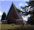
St Thomas More Catholic Church, Harlow
On Hodings Road
Image: © David Howard Taken: 12 Apr 2012
0.23 miles
6
St Thomas More RC Church, Harlow, Essex
Founded 1957.
Image: © Peter Stack Taken: 7 Jun 2009
0.23 miles