IMAGES TAKEN NEAR TO
Epping Upland, EPPING, CM16 6PJ
Introduction
This page details the photographs taken nearby to CM16 6PJ by members of the Geograph project.
The Geograph project started in 2005 with the aim of publishing, organising and preserving representative images for every square kilometre of Great Britain, Ireland and the Isle of Man.

There are currently over 7.5m images from over14,400 individuals and you can help contribute to the project by visiting https://www.geograph.org.uk
Image Map (6 Images)


Getting Data...Please wait
Leaflet Map data © OpenStreetMap
Images are licensed for reuse under creativecommons.org/licenses/by-sa/2.0
Notes
- Clicking on the map will re-center to the selected point.
- The higher the marker number, the further away the image location is from the centre of the postcode.
Image Listing (6 Images Found)
Images are licensed for reuse under creativecommons.org/licenses/by-sa/2.0
Image
Details
Distance
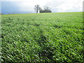
1
Public footpath sign at Chambers Manor Farm
Image: © Peter S
Taken: 17 Mar 2019
0.02 miles

3
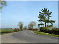
Epping Road (B181)
Looking towards Epping Green, whose houses are just visible in the distance.
Image: © Robin Webster
Taken: 13 Mar 2014
0.07 miles
4
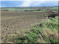
Passing Chambers Manor Farm
The houses of Epping can be seen in the distance a few miles away.
Image: © Peter S
Taken: 17 Mar 2019
0.15 miles
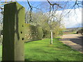
5
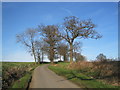
Cluster of trees around minor road
This attractive group of trees is on the minor road serving the four farms west from the Epping Upland hamlet.
Image: © O O'Brien
Taken: 11 Mar 2007
0.16 miles