IMAGES TAKEN NEAR TO
Buttercross Lane, EPPING, CM16 5AA
Introduction
This page details the photographs taken nearby to Buttercross Lane, CM16 5AA by members of the Geograph project.
The Geograph project started in 2005 with the aim of publishing, organising and preserving representative images for every square kilometre of Great Britain, Ireland and the Isle of Man.

There are currently over 7.5m images from over14,400 individuals and you can help contribute to the project by visiting https://www.geograph.org.uk
Image Map
Images are licensed for reuse under creativecommons.org/licenses/by-sa/2.0
Notes
- Clicking on the map will re-center to the selected point.
- The higher the marker number, the further away the image location is from the centre of the postcode.
Image Listing (100 Images Found)
Images are licensed for reuse under creativecommons.org/licenses/by-sa/2.0
Image
Details
Distance
7
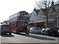
Rail shuttle bus
This vintage double-decker bus is operated by the Epping-Ongar railway and connects the Central Line station with the preserved steam railway.
Image: © Stephen Craven
Taken: 15 Mar 2014
0.06 miles
8
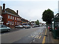
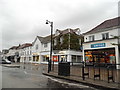
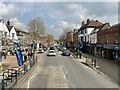
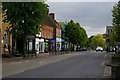
High Street, Epping
Epping developed into a linear settlement in the C19. It was on the coaching routes from London to Cambridge an Norwich.
Image: © Bikeboy
Taken: 7 Jun 2014
0.06 miles
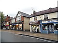
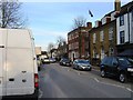
9
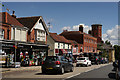
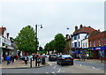
Epping
Looking across the High Street.
Image: © Peter Trimming
Taken: 14 Jul 2016
0.06 miles