IMAGES TAKEN NEAR TO
Kimpton Avenue, BRENTWOOD, CM15 9HA
Introduction
This page details the photographs taken nearby to Kimpton Avenue, CM15 9HA by members of the Geograph project.
The Geograph project started in 2005 with the aim of publishing, organising and preserving representative images for every square kilometre of Great Britain, Ireland and the Isle of Man.

There are currently over 7.5m images from over14,400 individuals and you can help contribute to the project by visiting https://www.geograph.org.uk
Image Map
Images are licensed for reuse under creativecommons.org/licenses/by-sa/2.0
Notes
- Clicking on the map will re-center to the selected point.
- The higher the marker number, the further away the image location is from the centre of the postcode.
Image Listing (17 Images Found)
Images are licensed for reuse under creativecommons.org/licenses/by-sa/2.0
Image
Details
Distance
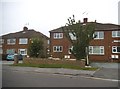
2
Rushdene Close at the junction of Doddinghurst Road
Image: © David Howard
Taken: 3 Sep 2017
0.12 miles
4
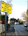
Sign on entrance to Costead Manor Road
Green Lane at the end of Costead Manor Road is marked on maps as a road.
See Image
Image: © terry joyce
Taken: 8 Dec 2009
0.18 miles
5
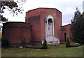
St George Church, Pilgrims Hatch, Essex
Image: © Peter Stack
Taken: 16 Oct 2009
0.18 miles
6
St George's Church on Ongar Road, Brentwood
Image: © David Howard
Taken: 25 May 2019
0.18 miles
7
St George's, North Brentwood
This unfinished church (it was meant to have a tower) was built in the Art Deco style in 1931 to serve new housing estates being built around Pilgrim's Hatch and north Brentwood.
Image: © Trevor Harris
Taken: 20 Jul 2009
0.18 miles
8
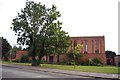
St George's Church, Greenshaw
Seen basking in the sunset on a beautiful spring evening. Looking north from Costead Manor Road.
Image: © Robert Lamb
Taken: 8 Apr 2011
0.19 miles
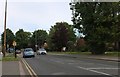
9
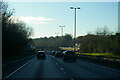
A12 Brentwood bypass westbound: approaching bridge under the A128
The houses to the right are on Hurstwood Avenue, part of which runs parallel to the top of the A12 cutting.
Image: © Christopher Hilton
Taken: 10 Dec 2022
0.19 miles
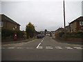
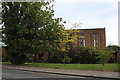
10
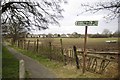
Footpath to King George Rd
The houses in the background are in Image
Image: © Glyn Baker
Taken: 2 Mar 2013
0.20 miles