IMAGES TAKEN NEAR TO
Ongar Road, BRENTWOOD, CM15 0LB
Introduction
This page details the photographs taken nearby to Ongar Road, CM15 0LB by members of the Geograph project.
The Geograph project started in 2005 with the aim of publishing, organising and preserving representative images for every square kilometre of Great Britain, Ireland and the Isle of Man.

There are currently over 7.5m images from over14,400 individuals and you can help contribute to the project by visiting https://www.geograph.org.uk
Image Map (Loading...)


Getting Data...Please wait
Leaflet Map data © OpenStreetMap
Images are licensed for reuse under creativecommons.org/licenses/by-sa/2.0
Notes
- Clicking on the map will re-center to the selected point.
- The higher the marker number, the further away the image location is from the centre of the postcode.
Image Listing (10 Images Found)
Images are licensed for reuse under creativecommons.org/licenses/by-sa/2.0
Image
Details
Distance
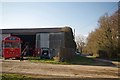
1
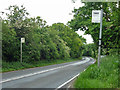
Langford Bridge Farm bus stops
On the A128 Ongar Road.
Image: © Robin Webster
Taken: 11 Jun 2013
0.02 miles
2
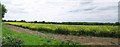
Oilseed Rape Panorama
Taken from the Drive to Langford Court
Image: © Glyn Baker
Taken: 11 May 2018
0.04 miles
3
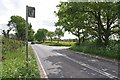
Ongar Rd at the Drive to Langford Court
The bus stop is for Langford Bridge Farm
Image: © Glyn Baker
Taken: 11 May 2018
0.05 miles
4
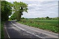
Bend in the Ongar Rd
looking back towards Langford Bridge Farm
Image: © Glyn Baker
Taken: 11 May 2018
0.11 miles
5
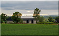
Barn at Langford Bridge Farm, Kelvedon Hatch
Looking over arable land.
Image: © Roger Jones
Taken: 7 Jun 2020
0.12 miles
6
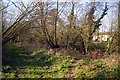
Bridleway & Estate Cottages
The houses in the background were probably part of the Great Myles estate (and perhaps still could be).
Image: © Glyn Baker
Taken: 25 Mar 2015
0.16 miles
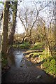
8
Bridleway Near Great Myles
Nearing the A128 Ongar Road
Image: © Glyn Baker
Taken: 25 Mar 2015
0.17 miles
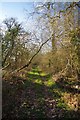
9
Bridleway Near Langford Bridge
Getting close to Image
Image: © Glyn Baker
Taken: 25 Mar 2015
0.19 miles
10

Ongar Garden Centre
It's located along the A128.
Image: © Robert Edwards
Taken: 2 Apr 2008
0.23 miles