IMAGES TAKEN NEAR TO
Blackmore Road, BRENTWOOD, CM15 0HX
Introduction
This page details the photographs taken nearby to Blackmore Road, CM15 0HX by members of the Geograph project.
The Geograph project started in 2005 with the aim of publishing, organising and preserving representative images for every square kilometre of Great Britain, Ireland and the Isle of Man.

There are currently over 7.5m images from over14,400 individuals and you can help contribute to the project by visiting https://www.geograph.org.uk
Image Map
Images are licensed for reuse under creativecommons.org/licenses/by-sa/2.0
Notes
- Clicking on the map will re-center to the selected point.
- The higher the marker number, the further away the image location is from the centre of the postcode.
Image Listing (5 Images Found)
Images are licensed for reuse under creativecommons.org/licenses/by-sa/2.0
Image
Details
Distance
1
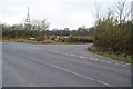
Road Junction on Blackmore Road
Junction of Blackmore Road and School Road. The communications mast is in the next square.
Image: © Julian P Guffogg
Taken: 5 Jan 2013
0.14 miles
2
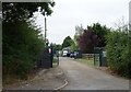
Entrance to Meadow Farm
Off Blackmore Road.
Image: © JThomas
Taken: 24 Aug 2022
0.20 miles
4
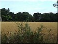
Stubble field near Meadow Farm
Off Blackmore Road.
Image: © JThomas
Taken: 24 Aug 2022
0.22 miles
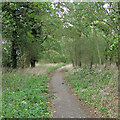
5
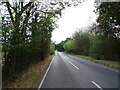
Blackmore Road near Meadow Farm
Towards Hook End.
Image: © JThomas
Taken: 24 Aug 2022
0.23 miles