IMAGES TAKEN NEAR TO
Tupman Close, CHELMSFORD, CM1 4UP
Introduction
This page details the photographs taken nearby to Tupman Close, CM1 4UP by members of the Geograph project.
The Geograph project started in 2005 with the aim of publishing, organising and preserving representative images for every square kilometre of Great Britain, Ireland and the Isle of Man.

There are currently over 7.5m images from over14,400 individuals and you can help contribute to the project by visiting https://www.geograph.org.uk
Image Map
Images are licensed for reuse under creativecommons.org/licenses/by-sa/2.0
Notes
- Clicking on the map will re-center to the selected point.
- The higher the marker number, the further away the image location is from the centre of the postcode.
Image Listing (10 Images Found)
Images are licensed for reuse under creativecommons.org/licenses/by-sa/2.0
Image
Details
Distance
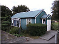
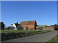
2
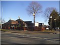
Bethel Chapel, Chelmsford
Junction of Mashbury Road and Chignals Road
Image: © John Myers
Taken: 29 Apr 2008
0.06 miles
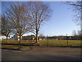
3
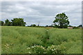
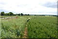
Footpath through rape
The rape in this field has pretty much finished flowering and the seed pods are swelling nicely.
Image: © Trevor Harris
Taken: 9 Jun 2015
0.14 miles
4
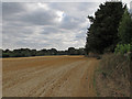
Crop Field Boundary and Hedgerow near Brickbarns Farm, Chignall
The public footpath as signposted on the ground is a little way from that shown on the map.
Image: © Roger Jones
Taken: 15 Aug 2018
0.15 miles
5
Public footpath by Brickbarns Farm
The footpath leads down to the A1060 near Writtle.
Image: © Robert Edwards
Taken: 14 Apr 2008
0.18 miles
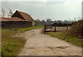
6
Brickbarns Farm near Chelmsford
Located on west side of Chelmsford on the road to Chignell St. Jamea
Image: © John Winfield
Taken: 9 Feb 2006
0.18 miles
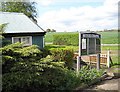
9
On the path by Brickbarns Farm
This section of path has been diverted from the route shown on the maps to avoid going through the area of farm buildings.
Image: © Trevor Harris
Taken: 9 Jun 2015
0.21 miles
10
Morrisons on Copperfield Road, Chelmsford
Image: © David Howard
Taken: 25 Feb 2018
0.24 miles