IMAGES TAKEN NEAR TO
Good Easter, CHELMSFORD, CM1 4RL
Introduction
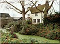
This page details the photographs taken nearby to CM1 4RL by members of the Geograph project.
The Geograph project started in 2005 with the aim of publishing, organising and preserving representative images for every square kilometre of Great Britain, Ireland and the Isle of Man.

There are currently over 7.5m images from over14,400 individuals and you can help contribute to the project by visiting https://www.geograph.org.uk
Image Map
Images are licensed for reuse under creativecommons.org/licenses/by-sa/2.0
Notes
- Clicking on the map will re-center to the selected point.
- The higher the marker number, the further away the image location is from the centre of the postcode.
Image Listing (5 Images Found)
Images are licensed for reuse under creativecommons.org/licenses/by-sa/2.0
Image
Details
Distance
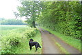
4
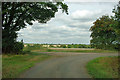
Turning for Hayron's Lane
The tarmac lane turning right does not seem to have an advertised name. To the left is the start of Hayron's Lane, a byway.
Image: © Robin Webster
Taken: 15 Sep 2011
0.19 miles
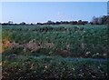
5
The Essex Way 44
For a short distance the path follows the minor road from Clatterford End.
Image: © Trevor Harris
Taken: 6 Jun 2010
0.20 miles