IMAGES TAKEN NEAR TO
Mascalls Lane, BRENTWOOD, CM14 5LR
Introduction
This page details the photographs taken nearby to Mascalls Lane, CM14 5LR by members of the Geograph project.
The Geograph project started in 2005 with the aim of publishing, organising and preserving representative images for every square kilometre of Great Britain, Ireland and the Isle of Man.

There are currently over 7.5m images from over14,400 individuals and you can help contribute to the project by visiting https://www.geograph.org.uk
Image Map (Loading...)


Getting Data...Please wait
Leaflet Map data © OpenStreetMap
Images are licensed for reuse under creativecommons.org/licenses/by-sa/2.0
Notes
- Clicking on the map will re-center to the selected point.
- The higher the marker number, the further away the image location is from the centre of the postcode.
Image Listing (41 Images Found)
Images are licensed for reuse under creativecommons.org/licenses/by-sa/2.0
Image
Details
Distance
1
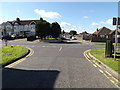
Westbourne Drive, Brook Street
At the junction with Mascalls Lane
Image: © Geographer
Taken: 19 Sep 2015
0.02 miles
2
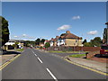
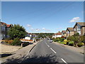
Mascalls Lane, Brook Street
At the junction with Westbourne Drive
Image: © Geographer
Taken: 19 Sep 2015
0.02 miles
3
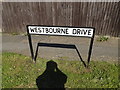
Westbourne Drive sign
On Westbourne Drive at the junction with Mascalls Lane
Image: © Geographer
Taken: 19 Sep 2015
0.02 miles
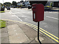
4
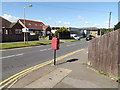
Mascalls Lane Postbox
On Mascalls Lane at the junction with Westbourne Drive
Postbox No.CM14 34
Image: © Geographer
Taken: 19 Sep 2015
0.03 miles
5
Mascalls Lane Postbox
On Mascalls Lane at the junction with Westbourne Drive
Postbox No.CM14 34
Image: © Geographer
Taken: 19 Sep 2015
0.03 miles
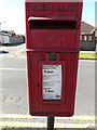
6
Mascalls Lane Postbox
On Mascalls Lane at the junction with Westbourne Drive
Postbox No.CM14 34
Image: © Geographer
Taken: 19 Sep 2015
0.03 miles
7
Mascalls Lane Postbox
On Mascalls Lane at the junction with Westbourne Drive
Postbox No.CM14 34
Image: © Geographer
Taken: 19 Sep 2015
0.03 miles
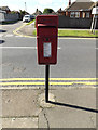
8
Mascalls Lane Postbox
On Mascalls Lane at the junction with Westbourne Drive
Postbox No.CM14 3
(Close Up)
Image: © Geographer
Taken: 19 Sep 2015
0.03 miles
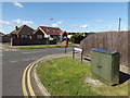
9
Mascalls Lane, Brook Street
Near Mascalls Lane Railway Bridge
Image: © Geographer
Taken: 19 Sep 2015
0.07 miles
10
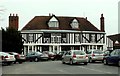
'The Marygreen Manor Hotel'
This was originally a 16th century Manor House.
Image: © Robert Edwards
Taken: 14 Feb 2007
0.07 miles