
IMAGES TAKEN NEAR TO
Rollason Way, BRENTWOOD, CM14 4AU
Introduction
This page details the photographs taken nearby to Rollason Way, CM14 4AU by members of the Geograph project.
The Geograph project started in 2005 with the aim of publishing, organising and preserving representative images for every square kilometre of Great Britain, Ireland and the Isle of Man.

There are currently over 7.5m images from over14,400 individuals and you can help contribute to the project by visiting https://www.geograph.org.uk
Image Map
Images are licensed for reuse under creativecommons.org/licenses/by-sa/2.0
Notes
- Clicking on the map will re-center to the selected point.
- The higher the marker number, the further away the image location is from the centre of the postcode.
Image Listing (49 Images Found)
Images are licensed for reuse under creativecommons.org/licenses/by-sa/2.0
Image
Details
Distance
1
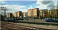
Car park and housing near Brentwood Station
Viewed from railway line.
Image: © Clint Mann
Taken: 3 May 2016
0.04 miles
2
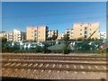
Flats on Rollason Way, Brentwood
The flats are seen from the railway, across the car park of Brentwood station.
Image: © Christopher Hilton
Taken: 26 Sep 2018
0.05 miles
3
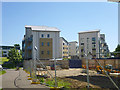
Flats, Rollason Way, Brentwood
Parts of this new development were still being finished at the time of this view.
Image: © Robin Webster
Taken: 26 May 2012
0.08 miles
5
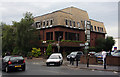
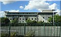
Highway House
Offices on the corner of Wharf Road and Kings Road, seen during the evening rush hour.
Image: © Martin Addison
Taken: 9 Sep 2008
0.13 miles
6
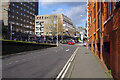
The Parade, Brentwood
The Parade leads up from Brentwood station towards the town centre.
Image: © Stephen McKay
Taken: 11 Jan 2023
0.14 miles
7
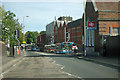
By Brentwood station
The road is Warley Hill, nearing the end of its not very steep descent.
Image: © Robin Webster
Taken: 15 Sep 2011
0.14 miles
8
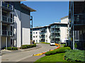
New flats, Brentwood
A development still in progress.
Image: © Robin Webster
Taken: 26 May 2012
0.14 miles
9
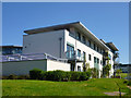
Flats, Rollason Way, Brentwood
Parts of this new development were still being built at the time of this view.
Image: © Robin Webster
Taken: 26 May 2012
0.14 miles
10
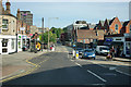
Warley Hill near Brentwood station
The railway passes under the road at the bottom of the hill.
Image: © Robin Webster
Taken: 15 Sep 2011
0.15 miles