IMAGES TAKEN NEAR TO
Kingsley Road, BRENTWOOD, CM13 2SH
Introduction
This page details the photographs taken nearby to Kingsley Road, CM13 2SH by members of the Geograph project.
The Geograph project started in 2005 with the aim of publishing, organising and preserving representative images for every square kilometre of Great Britain, Ireland and the Isle of Man.

There are currently over 7.5m images from over14,400 individuals and you can help contribute to the project by visiting https://www.geograph.org.uk
Image Map
Images are licensed for reuse under creativecommons.org/licenses/by-sa/2.0
Notes
- Clicking on the map will re-center to the selected point.
- The higher the marker number, the further away the image location is from the centre of the postcode.
Image Listing (9 Images Found)
Images are licensed for reuse under creativecommons.org/licenses/by-sa/2.0
Image
Details
Distance
3
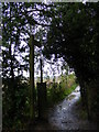
Footpath to Hanging Hill Lane & Church Lane
Off Hall Green Lane
Brentwood Footpath No.77
Image: © Geographer
Taken: 1 Oct 2010
0.18 miles
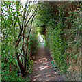
5
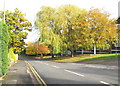
Autumn colour at Hanging Hill Lane, Hutton
Image: © Derek Voller
Taken: 7 Nov 2008
0.21 miles
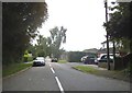
6
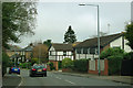
Hanging Hill Lane, Hutton
An unpleasant name, but probably a reasonable place to live apart from it being quite a busy road now.
Image: © Robin Webster
Taken: 25 Mar 2012
0.22 miles
8
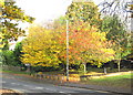
More autumn colour at Hanging Hill Lane
Image: © Derek Voller
Taken: 7 Nov 2008
0.24 miles
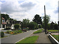
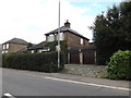
9
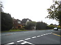
Hanging Hill Lane at the junction of Hall Green Lane
Image: © David Howard
Taken: 3 Sep 2017
0.24 miles