IMAGES TAKEN NEAR TO
CM13 1UD
Introduction
This page details the photographs taken nearby to CM13 1UD by members of the Geograph project.
The Geograph project started in 2005 with the aim of publishing, organising and preserving representative images for every square kilometre of Great Britain, Ireland and the Isle of Man.

There are currently over 7.5m images from over14,400 individuals and you can help contribute to the project by visiting https://www.geograph.org.uk
Image Map
Images are licensed for reuse under creativecommons.org/licenses/by-sa/2.0
Notes
- Clicking on the map will re-center to the selected point.
- The higher the marker number, the further away the image location is from the centre of the postcode.
Image Listing (30 Images Found)
Images are licensed for reuse under creativecommons.org/licenses/by-sa/2.0
Image
Details
Distance
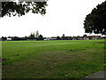
2
Path to Harrison Close
Over Hutton Recreation Grounds
Image: © Geographer
Taken: 19 Sep 2015
0.10 miles
3
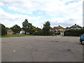
Hutton Recreation Grounds Car Park
Looking towards Wash Road
Image: © Geographer
Taken: 19 Sep 2015
0.11 miles
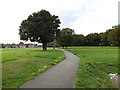
4
Path to Wash Road
Over Hutton Recreation Grounds
Image: © Geographer
Taken: 19 Sep 2015
0.11 miles
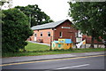
6
Hutton All Saints Scout Hut
Off Wash Road
Image: © Geographer
Taken: 19 Sep 2015
0.13 miles
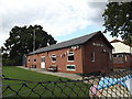
7
Hutton All Saints Scout Hut
Off Wash Road
Image: © Geographer
Taken: 19 Sep 2015
0.13 miles
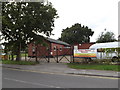
8
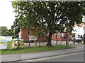
Woodland Avenue, Hutton
Woodland Avenue is a residential road in Hutton, near Brentwood.
Signs indicate that the road has a 20mph speed limit; heavy lorries are prohibited from using it as a through route.
Image: © Malc McDonald
Taken: 7 Jun 2015
0.13 miles
9
Hutton All Saints Scout Hut
Off Wash Road
Image: © Geographer
Taken: 19 Sep 2015
0.13 miles
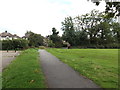
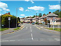
10
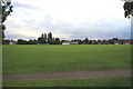
Playing Fields off Wash Road, Hutton
Image: © Graham Loveland
Taken: 20 Jun 2009
0.13 miles