IMAGES TAKEN NEAR TO
Rectory Road, BILLERICAY, CM12 9UA
Introduction
This page details the photographs taken nearby to Rectory Road, CM12 9UA by members of the Geograph project.
The Geograph project started in 2005 with the aim of publishing, organising and preserving representative images for every square kilometre of Great Britain, Ireland and the Isle of Man.

There are currently over 7.5m images from over14,400 individuals and you can help contribute to the project by visiting https://www.geograph.org.uk
Image Map (Loading...)


Getting Data...Please wait
Leaflet Map data © OpenStreetMap
Images are licensed for reuse under creativecommons.org/licenses/by-sa/2.0
Notes
- Clicking on the map will re-center to the selected point.
- The higher the marker number, the further away the image location is from the centre of the postcode.
Image Listing (28 Images Found)
Images are licensed for reuse under creativecommons.org/licenses/by-sa/2.0
Image
Details
Distance
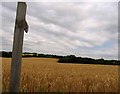
2
River Crouch - Parish Boundary of Little Burstead
This small watercourse joins the infant River Crouch and is the boundary of the Parish of Little Burstead, to the south is the Borough of Basildon.
Image: © Roger Jones
Taken: 12 May 2019
0.04 miles
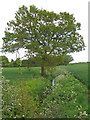
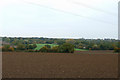
3
Footpath to Little Burstead
The farmer has made no attempt to mark the line of the footpath.
Image: © Andrew Tatlow
Taken: 26 Jul 2013
0.09 miles
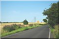
4
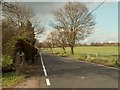
Rectory Road, leading to Little Burstead
Image: © Robert Edwards
Taken: 31 Mar 2008
0.09 miles
5
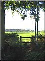
Stile & Footpath, Little Burstead, Essex
Footpath from New Road to Steeple View Farm Looking south with Fords Research Headquarters on the horizon.
Image: © John Winfield
Taken: 20 Oct 2005
0.10 miles
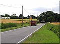
6
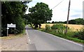
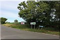
Dunton Road & Rectory Road
This is the junction of Dunton & rectory roads
Image: © Glyn Baker
Taken: 22 Jul 2012
0.13 miles
8
Part of a Panorama 2
This is one of three photos taken from the layby on the A127 to show a panoramamic shot of the landscape.
The other photos are Image and Image
Image: © terry joyce
Taken: 29 Oct 2010
0.14 miles
9

Rectory Road at the junction of Dunton Road
Image: © David Howard
Taken: 25 May 2019
0.14 miles
10
Dunton Road near Laindon
The sign has been swapped in the last couple of years sending Southend drivers right instead of left. Of course Southend is east so little point in doing so.
Image: © David Howard
Taken: 25 May 2019
0.14 miles