IMAGES TAKEN NEAR TO
New Road, BILLERICAY, CM12 9TS
Introduction
This page details the photographs taken nearby to New Road, CM12 9TS by members of the Geograph project.
The Geograph project started in 2005 with the aim of publishing, organising and preserving representative images for every square kilometre of Great Britain, Ireland and the Isle of Man.

There are currently over 7.5m images from over14,400 individuals and you can help contribute to the project by visiting https://www.geograph.org.uk
Image Map (Loading...)


Getting Data...Please wait
Leaflet Map data © OpenStreetMap
Images are licensed for reuse under creativecommons.org/licenses/by-sa/2.0
Notes
- Clicking on the map will re-center to the selected point.
- The higher the marker number, the further away the image location is from the centre of the postcode.
Image Listing (15 Images Found)
Images are licensed for reuse under creativecommons.org/licenses/by-sa/2.0
Image
Details
Distance
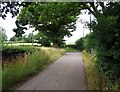
2
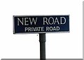
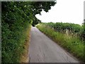
New Road, Little Burstead, Essex
Private road running east from Rectory Road, Little Burstead
Image: © John Winfield
Taken: 20 Oct 2005
0.10 miles
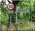
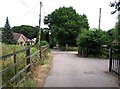
7
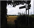
View towards Ford Research Centre from New Road 26 July 2013
Compare with Image taken on 20 October 2005.
Image: © Andrew Tatlow
Taken: 26 Jul 2013
0.17 miles
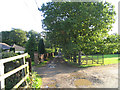
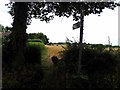
8
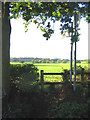
Stile & Footpath, Little Burstead, Essex
Footpath from New Road to Steeple View Farm Looking south with Fords Research Headquarters on the horizon.
Image: © John Winfield
Taken: 20 Oct 2005
0.21 miles