IMAGES TAKEN NEAR TO
Second Avenue, BILLERICAY, CM12 9PP
Introduction
This page details the photographs taken nearby to Second Avenue, CM12 9PP by members of the Geograph project.
The Geograph project started in 2005 with the aim of publishing, organising and preserving representative images for every square kilometre of Great Britain, Ireland and the Isle of Man.

There are currently over 7.5m images from over14,400 individuals and you can help contribute to the project by visiting https://www.geograph.org.uk
Image Map
Images are licensed for reuse under creativecommons.org/licenses/by-sa/2.0
Notes
- Clicking on the map will re-center to the selected point.
- The higher the marker number, the further away the image location is from the centre of the postcode.
Image Listing (17 Images Found)
Images are licensed for reuse under creativecommons.org/licenses/by-sa/2.0
Image
Details
Distance
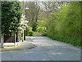
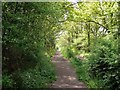
1
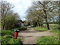
The end of Frithwood Lane
A bridleway from Laindon Common expands into a residential road.
Image: © Robin Webster
Taken: 30 Apr 2013
0.05 miles
2
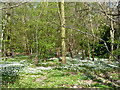
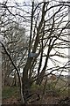
Frith Wood
The ground flora is dominated by Wood Anemone at this time of year. It is a private wood, as several notices make clear.
Image: © Robin Webster
Taken: 30 Apr 2013
0.09 miles
3
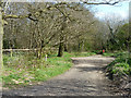
The end of Frithwood Lane
The route continues as a bridleway to Laindon Common.
Image: © Robin Webster
Taken: 30 Apr 2013
0.10 miles
4
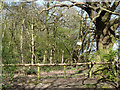
Frith Wood
The faded sign says 'Private keep out'.
Image: © Robin Webster
Taken: 30 Apr 2013
0.13 miles
6
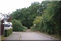
Wiggins Lane
This is the point where Wiggins Lane becomes Image
Image: © Glyn Baker
Taken: 5 Sep 2009
0.14 miles
7
Byway 45
Image: © Glyn Baker
Taken: 5 Sep 2009
0.15 miles
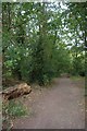
8
Wiggin's Lane
A public byway that loses its tarmac surface on leaving the built-up area.
Image: © Robin Webster
Taken: 30 Apr 2013
0.15 miles
10
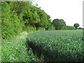
Arable Land near Wiggin's Lane, Little Burstead
Image: © Roger Jones
Taken: 25 May 2019
0.19 miles