IMAGES TAKEN NEAR TO
Stowe's Lane, SOUTHMINSTER, CM0 7XB
Introduction
This page details the photographs taken nearby to Stowe's Lane, CM0 7XB by members of the Geograph project.
The Geograph project started in 2005 with the aim of publishing, organising and preserving representative images for every square kilometre of Great Britain, Ireland and the Isle of Man.

There are currently over 7.5m images from over14,400 individuals and you can help contribute to the project by visiting https://www.geograph.org.uk
Image Map
Images are licensed for reuse under creativecommons.org/licenses/by-sa/2.0
Notes
- Clicking on the map will re-center to the selected point.
- The higher the marker number, the further away the image location is from the centre of the postcode.
Image Listing (13 Images Found)
Images are licensed for reuse under creativecommons.org/licenses/by-sa/2.0
Image
Details
Distance
1
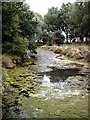
Dried Up Pond at Stowes farm
It has been dry lately.
Image: © Glyn Baker
Taken: 3 Nov 2016
0.14 miles
5
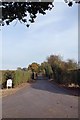
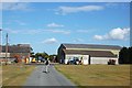
Stowe's Lane
Footpath on private road leading to Stows farm.
Image: © Roger Jones
Taken: 26 Feb 2012
0.17 miles
6
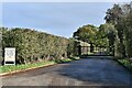
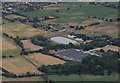
Tillingham, Stows Farm: Gated private entrance
Image: © Michael Garlick
Taken: 1 Nov 2022
0.19 miles
7
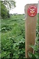
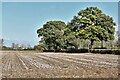
St Peter's Way West of Tillingham
The footpath passes to the right of the hedge in the background; there is a rather Image label on the side of the post.
Image: © Glyn Baker
Taken: 7 May 2014
0.19 miles
8
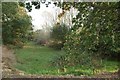
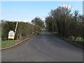
Approaching Stows Farm, Tillingham
On the footpath from St Lawrence, nearing Tillingham.
Image: © Trevor Harris
Taken: 19 Jul 2009
0.20 miles
9

Off Piste
The Friends are a bit off their usual Manor doing good works at this end of the county!
Image: © Glyn Baker
Taken: 7 May 2014
0.21 miles