IMAGES TAKEN NEAR TO
Bate-Dudley Drive, SOUTHMINSTER, CM0 7QG
Introduction
This page details the photographs taken nearby to Bate-Dudley Drive, CM0 7QG by members of the Geograph project.
The Geograph project started in 2005 with the aim of publishing, organising and preserving representative images for every square kilometre of Great Britain, Ireland and the Isle of Man.

There are currently over 7.5m images from over14,400 individuals and you can help contribute to the project by visiting https://www.geograph.org.uk
Image Map
Images are licensed for reuse under creativecommons.org/licenses/by-sa/2.0
Notes
- Clicking on the map will re-center to the selected point.
- The higher the marker number, the further away the image location is from the centre of the postcode.
Image Listing (34 Images Found)
Images are licensed for reuse under creativecommons.org/licenses/by-sa/2.0
Image
Details
Distance

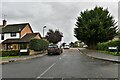

7
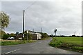
East End
Looking along east End road from a bend.
Image: © Trevor Harris
Taken: 17 Nov 2011
0.09 miles
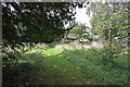
8
Roman Road near Bradwell on Sea
This square is intersected by a long straight road, which dates back to Roman times.
Image: © Hywel Williams
Taken: 5 Nov 2005
0.12 miles