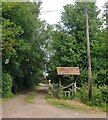
IMAGES TAKEN NEAR TO
Stansgate Road, SOUTHMINSTER, CM0 7NU

Introduction

This page details the photographs taken nearby to Stansgate Road, CM0 7NU by members of the Geograph project.

The Geograph project started in 2005 with the aim of publishing, organising and preserving representative images for every square kilometre of Great Britain, Ireland and the Isle of Man.

There are currently over 7.5m images from over14,400 individuals and you can help contribute to the project by visiting https://www.geograph.org.uk

Image Map


Images are licensed for reuse under creativecommons.org/licenses/by-sa/2.0
Notes
  • Clicking on the map will re-center to the selected point.
  • The higher the marker number, the further away the image location is from the centre of the postcode.

Image Listing (10 Images Found)

Images are licensed for reuse under creativecommons.org/licenses/by-sa/2.0
Image
Details
Distance
1
Entrance to Stansgate Abbey Farm
Also to Stansgate House a home of the late Tony Benn (where he spent all his childhood holidays)
Image: © Trevor Harris Taken: 11 Jan 2015
0.02 miles
2
The entrance to Stansgate Abbey Farm
The estate is connected with the Wedgwood-Benn family. As a young man the late Tony Benn MP set a precedent by renouncing the peerage he was due to inherit, foregoing the title of Viscount Stansgate.
Image: © Stefan Czapski Taken: 11 Jun 2016
0.04 miles
3
Blackwater Beach
This is the pebble beach on the Blackwater to the west of Stansgate Abbey Farm
Image: © Glyn Baker Taken: 16 Aug 2006
0.08 miles
4
Marconi Sailing Club
This is the clubhouse at the Marconi Sailing Club on the River Blackwater. Quite how you become a member now Marconi is no more you will have to determine from their website http://www.marconi-sc.org.uk/
Image: © Glyn Baker Taken: 16 Aug 2006
0.10 miles
5
Marconi Sailing Club
Originally formed by employees of the Marconi Company in Chelmsford, the club retained the Marconi name after the company's demise. According to the club's website, the white building was originally a wash house built for the use of the families of officers from a watch vessel moored offshore in the nineteenth century.
Image: © Paul Franks Taken: 17 Jun 2017
0.12 miles
6
Former Coastguard Cottage
Now in the area of Marconi Sailing Club.
Image: © Trevor Harris Taken: 11 Jan 2015
0.14 miles
7
Foreshore and Jetty
The Marconi Sailing Club jetty. In the distance are barges taking part in the 2017 Blackwater Sailing Barge Match.
Image: © Paul Franks Taken: 17 Jun 2017
0.16 miles
8
Gun Emplacement
One of the wartime defences on the Blackwater Estuary. The hut and mast are used by Marconi Sailing Club.
Image: © Paul Franks Taken: 17 Jun 2017
0.22 miles
9
Ditch between flood defence and arable land
What looks like a borrow dyke http://www.geograph.org.uk/tagged/borrow%20dyke behind the coastal defences near Stansgate Abbey Farm appears to have dried up to the extent that brush is now growing along its course. This land is in the parish of Steeple.
Image: © Roger Jones Taken: 22 Sep 2013
0.22 miles
10
Blackwater Beach
The tide is quite high so not much of the beach can be seen from this section of the footpath that runs along the coastal defences on the Blackwater Estuary, this section in the parish of Steeple.
Image: © Roger Jones Taken: 22 Sep 2013
0.22 miles