IMAGES TAKEN NEAR TO
The Marshes, SOUTHMINSTER, CM0 7JJ
Introduction
This page details the photographs taken nearby to The Marshes, CM0 7JJ by members of the Geograph project.
The Geograph project started in 2005 with the aim of publishing, organising and preserving representative images for every square kilometre of Great Britain, Ireland and the Isle of Man.

There are currently over 7.5m images from over14,400 individuals and you can help contribute to the project by visiting https://www.geograph.org.uk
Image Map (Loading...)


Getting Data...Please wait
Leaflet Map data © OpenStreetMap
Images are licensed for reuse under creativecommons.org/licenses/by-sa/2.0
Notes
- Clicking on the map will re-center to the selected point.
- The higher the marker number, the further away the image location is from the centre of the postcode.
Image Listing (5 Images Found)
Images are licensed for reuse under creativecommons.org/licenses/by-sa/2.0
Image
Details
Distance
1
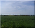
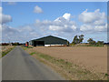
View from Hall Road overlooking Wraywick farm
Image: © David Howard
Taken: 20 Jun 2012
0.02 miles
2
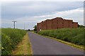
Haystack
This haystack is on the minor road that serves the farms at the south eastern end of the Dengie Peninsula
Image: © Glyn Baker
Taken: 4 Jun 2006
0.05 miles
5
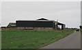
Barn, Broadward Farm
Quite new, in the place of some much meaner buildings.
Image: © Robin Webster
Taken: 22 Oct 2016
0.16 miles