
IMAGES TAKEN NEAR TO
Main Road, HOLYWELL, CH8 9SR
Introduction
This page details the photographs taken nearby to Main Road, CH8 9SR by members of the Geograph project.
The Geograph project started in 2005 with the aim of publishing, organising and preserving representative images for every square kilometre of Great Britain, Ireland and the Isle of Man.

There are currently over 7.5m images from over14,400 individuals and you can help contribute to the project by visiting https://www.geograph.org.uk
Image Map
Images are licensed for reuse under creativecommons.org/licenses/by-sa/2.0
Notes
- Clicking on the map will re-center to the selected point.
- The higher the marker number, the further away the image location is from the centre of the postcode.
Image Listing (26 Images Found)
Images are licensed for reuse under creativecommons.org/licenses/by-sa/2.0
Image
Details
Distance
1

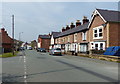
House Conversion, Ffynnongroyw
What looks like a former chapel or hall being converted into a dwelling in Main Street, Ffynnongroyw.
Image: © Jeff Buck
Taken: 5 May 2016
0.01 miles
3
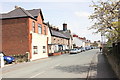
Main Road, Ffynnongroyw
Looking east along Main Road in the former mining village of Ffynnongroyw.
Image: © Jeff Buck
Taken: 5 May 2016
0.03 miles
4
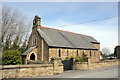
All Saints Church, Ffynnongroyw
All Saints Church in Main Street, Ffynnongroyw was designed by George Edmund Street in 1881 and completed in 1882, the year of his death. Behind the church is a community forest garden created by members of the church and the local community in 2011.
Source: historypoints.org
Image: © Jeff Buck
Taken: 5 May 2016
0.06 miles
5
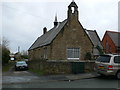
Former Ffynnongroyw School
Grade II listed as a mid to late C19 purpose-built British School retaining early character, and for its association with the development of the industrial village of Ffynnongroyw. https://britishlistedbuildings.co.uk/300000593-former-ffynnongroyw-school-llanasa
Image: © Eirian Evans
Taken: 13 Feb 2012
0.06 miles
6
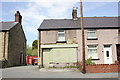
Boarded-up shop, Main Road, Ffynnongroyw
A boarded-up terraced shop at the end of a small row of houses called School Row in Ffynnongroyw.
Image: © Jeff Buck
Taken: 5 May 2016
0.08 miles
9
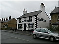
Y Goron/The Crown (closed), Ffynnongroyw
The Crown Inn at Ffynnongroyw ceased trading in 2010 after the death of the former landlord. The pub had been making a loss for a while and unable to find a replacement landlord, the brewery which owned the pub put the property up for sale. Flintshire County Council have decided that the property is no longer a viable business and will now be demolished to make way for a housing scheme.
Source: Flintshire County Council
Image: © Jeff Buck
Taken: 5 May 2016
0.11 miles
10
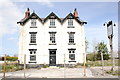
Y Goron/The Crown (closed), Ffynnongroyw
The Crown Inn at Ffynnongroyw ceased trading in 2010 after the death of the former landlord. The pub had been making a loss for a while and unable to find a replacement landlord, the brewery which owned the pub put the property up for sale. Flintshire County Council have decided that the property is no longer a viable business and will now be demolished to make way for a housing scheme.
Source: Flintshire County Council
Image: © Jeff Buck
Taken: 5 May 2016
0.11 miles