
IMAGES TAKEN NEAR TO
Lime Bank, HOLYWELL, CH8 9QB
Introduction
This page details the photographs taken nearby to Lime Bank, CH8 9QB by members of the Geograph project.
The Geograph project started in 2005 with the aim of publishing, organising and preserving representative images for every square kilometre of Great Britain, Ireland and the Isle of Man.

There are currently over 7.5m images from over14,400 individuals and you can help contribute to the project by visiting https://www.geograph.org.uk
Image Map
Images are licensed for reuse under creativecommons.org/licenses/by-sa/2.0
Notes
- Clicking on the map will re-center to the selected point.
- The higher the marker number, the further away the image location is from the centre of the postcode.
Image Listing (5 Images Found)
Images are licensed for reuse under creativecommons.org/licenses/by-sa/2.0
Image
Details
Distance
1
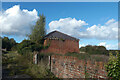
Gwaith brics addurniadol / Decorative brickwork
Image: © Ceri Thomas
Taken: 25 Oct 2021
0.07 miles
2
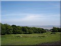
Maes Pennant
Fields and trees leading down to the coast.
Image: © Dot Potter
Taken: 6 Jun 2006
0.15 miles
3
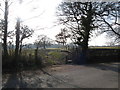
Stile and footpath
This leads across pasture land to Bychton Cottages and Whitford Wood
Image: © Maggie Cox
Taken: 3 Mar 2013
0.17 miles
4
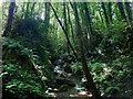
Waterfall Near Maes Pennant
Not the most dramatic of waterfalls, but the level of noise is quite substantial, and on a hot summer afternoon, it was quite refreshing to spend time here, with the tall trees also blotting out most of the sun's rays.
Image: © mezmrz
Taken: 5 Jul 2012
0.18 miles
5

Bryn Pennant Primary School, Maes Pennant
Image: © Eirian Evans
Taken: 31 Jan 2009
0.24 miles