
IMAGES TAKEN NEAR TO
Gwespyr, HOLYWELL, CH8 9JS
Introduction
This page details the photographs taken nearby to CH8 9JS by members of the Geograph project.
The Geograph project started in 2005 with the aim of publishing, organising and preserving representative images for every square kilometre of Great Britain, Ireland and the Isle of Man.

There are currently over 7.5m images from over14,400 individuals and you can help contribute to the project by visiting https://www.geograph.org.uk
Image Map
Images are licensed for reuse under creativecommons.org/licenses/by-sa/2.0
Notes
- Clicking on the map will re-center to the selected point.
- The higher the marker number, the further away the image location is from the centre of the postcode.
Image Listing (17 Images Found)
Images are licensed for reuse under creativecommons.org/licenses/by-sa/2.0
Image
Details
Distance
1

The Talacre Arms Pub
On a steep bend in the road leading from Gwespyr to the A548 coast road near Talacre.
Image: © Maggie Cox
Taken: 29 Mar 2013
0.03 miles
2

Footpath
Leading down through steep woodland across the A548, past caravan parks to the beach near Talacre
Image: © Maggie Cox
Taken: 29 Mar 2013
0.08 miles
3
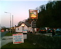
The Lodge Inn, Gwespyr
Had a pint in here tonite, watching the Everton v Fulham (4-1) match here live on sky on their brilliant big screen in their sportsmans bar at the back of the pub.
Image: © mezmrz
Taken: 6 Apr 2007
0.10 miles
4
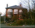
Derelict Property on A548, Gwespyr
I classed this as a disused public house, as the site does not have disused house as a classification. The property does seem to have displayed a sign once. There seems to be a few derelict properties that adorn this coast road (A548) in Flintshire. Don't know whether this is a problem, but the Flintshire Council is promoting an "Empty Homes Scheme" on its website. The structure of this building looks sound to me, but those trees seem to look a problem should anyone renovate.
Image: © mezmrz
Taken: 6 Apr 2007
0.14 miles
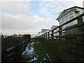
8
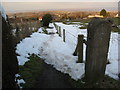
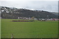
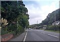
Footpath from Gwespyr
With views on a good day of Point of Ayr, Liverpool Bay, the Dee Estuary and the Wirral
Image: © Maggie Cox
Taken: 29 Mar 2013
0.20 miles
9
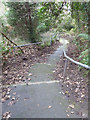
Very steep footpath
Linking Gwespyr to the A548
Image: © Gary Rogers
Taken: 11 Jan 2015
0.21 miles
10
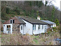
Houses at bottom of footpath to the A548 from Gwespyr
Image: © Gary Rogers
Taken: 11 Jan 2015
0.22 miles