IMAGES TAKEN NEAR TO
Glan Asaph Terrace, HOLYWELL, CH8 9EF
Introduction
This page details the photographs taken nearby to Glan Asaph Terrace, CH8 9EF by members of the Geograph project.
The Geograph project started in 2005 with the aim of publishing, organising and preserving representative images for every square kilometre of Great Britain, Ireland and the Isle of Man.

There are currently over 7.5m images from over14,400 individuals and you can help contribute to the project by visiting https://www.geograph.org.uk
Image Map
Images are licensed for reuse under creativecommons.org/licenses/by-sa/2.0
Notes
- Clicking on the map will re-center to the selected point.
- The higher the marker number, the further away the image location is from the centre of the postcode.
Image Listing (9 Images Found)
Images are licensed for reuse under creativecommons.org/licenses/by-sa/2.0
Image
Details
Distance
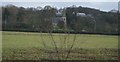
2
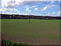
Field with electricity pole
With my back to Duke of Lancaster ship.
Image: © Bob Abell
Taken: 7 Apr 2009
0.18 miles
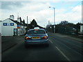
4
Christ Church, Glan-y-don as seen from Wales Coast Path
Image: © Colin Park
Taken: 21 Oct 2015
0.20 miles
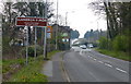
8

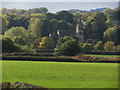
Christ Church, Mostyn
The parish of Mostyn was formed on 23 May 1844, from the townships of Bychton, Mertyn Isglan, and part of Trefostyn, all of which had been in the parish of Whitford until that date. The foundation stone for the new church was laid on 30 May 1842, and the building was completed in September 1844.
Image: © Eirian Evans
Taken: 31 Jan 2009
0.23 miles
9
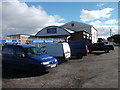
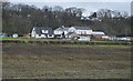
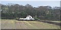
Mostyn Garage
A small but very busy vehicle repair and maintenance business beside the A548.
Image: © John Haynes
Taken: 16 Oct 2012
0.25 miles