
IMAGES TAKEN NEAR TO
Church Terrace, HOLYWELL, CH8 8JR
Introduction
This page details the photographs taken nearby to Church Terrace, CH8 8JR by members of the Geograph project.
The Geograph project started in 2005 with the aim of publishing, organising and preserving representative images for every square kilometre of Great Britain, Ireland and the Isle of Man.

There are currently over 7.5m images from over14,400 individuals and you can help contribute to the project by visiting https://www.geograph.org.uk
Image Map
Images are licensed for reuse under creativecommons.org/licenses/by-sa/2.0
Notes
- Clicking on the map will re-center to the selected point.
- The higher the marker number, the further away the image location is from the centre of the postcode.
Image Listing (9 Images Found)
Images are licensed for reuse under creativecommons.org/licenses/by-sa/2.0
Image
Details
Distance
4
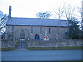
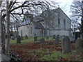
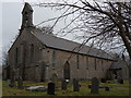
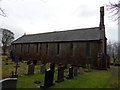
Eglwys Crist, Rhes-y-Cae
A view from the south of Eglwys Crist (Christ Church) at Rhes-y-Cae.
Image: © Phil Williams
Taken: 2 Jan 2006
0.07 miles
5
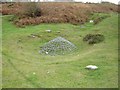
Clwyd Cap on Halkyn Mountain
The metal structure is known as a "Clwyd Cap", and was used to cap open mineshafts. This former lead mine would have been created in the 19th or early 20th century. Many Clwyd Caps are also covered in rocks and cement to completely seal the mineshaft.
Image: © Aaron Thomas
Taken: 5 Nov 2006
0.09 miles
6

Sheep at bus shelter
Bus shelter in Rhes-y-Cae on Halkyn Mountain. The sheep is waiting for the 14A to Denbigh. Silly sheep - it doesn't run on a Sunday.
Image: © Aaron Thomas
Taken: 5 Nov 2006
0.10 miles
7
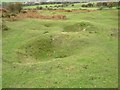
Lead mines
The remains of lead mines. Halkyn Mountain was extensively mined in the 19th and early 20th century, and the landscape is pock-marked with the remnants of small mines like these.
Image: © Aaron Thomas
Taken: 5 Nov 2006
0.11 miles
8
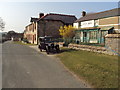
Rhes y Cae, Flintshire
Looking down the main road in Rhes y Cae towards The Miners Arms.
Image: © Tom Stapledon
Taken: 25 Mar 2011
0.17 miles
