
IMAGES TAKEN NEAR TO
The Catch, HOLYWELL, CH8 8EG
Introduction
This page details the photographs taken nearby to The Catch, CH8 8EG by members of the Geograph project.
The Geograph project started in 2005 with the aim of publishing, organising and preserving representative images for every square kilometre of Great Britain, Ireland and the Isle of Man.

There are currently over 7.5m images from over14,400 individuals and you can help contribute to the project by visiting https://www.geograph.org.uk
Image Map
Images are licensed for reuse under creativecommons.org/licenses/by-sa/2.0
Notes
- Clicking on the map will re-center to the selected point.
- The higher the marker number, the further away the image location is from the centre of the postcode.
Image Listing (5 Images Found)
Images are licensed for reuse under creativecommons.org/licenses/by-sa/2.0
Image
Details
Distance
1
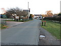
Oche Y Bryn in Halkyn
Looking south-eastward from Halkyn Parish Hall.
Image: © Peter Wood
Taken: 18 Nov 2018
0.14 miles
2
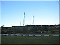
Halkyn Mountain
A view looking north across a quarry access road to the twin radio towers on Halkyn Mountain
Image: © Phil Williams
Taken: 1 Jan 2006
0.17 miles
3
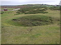
Miner's bell pit near Windmill
This area is pockmarked with former mining activities, where lead and zinc were extracted from fissures in the rock.
Image: © Adie Jackson
Taken: 10 Nov 2007
0.19 miles
4
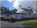
Blue Bell Inn, Halkyn
About 850 feet up on Halkyn Mountain stands this award winning real ale free house.
Image: © Steve Marquis
Taken: 18 Aug 2010
0.20 miles
5
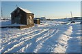
Tin shed and snow
200 mm of Snow and then some on Halkyn Common, Pant Quarry to the right of the photograph. The snow flakes had grown to a spectacular size, and it was jolly cold too.
Image: © Ed Lloyd-Hughes
Taken: Unknown
0.25 miles