
IMAGES TAKEN NEAR TO
Plas Dewi, Well Street, HOLYWELL, CH8 7PP
Introduction
This page details the photographs taken nearby to Plas Dewi, Well Street, CH8 7PP by members of the Geograph project.
The Geograph project started in 2005 with the aim of publishing, organising and preserving representative images for every square kilometre of Great Britain, Ireland and the Isle of Man.

There are currently over 7.5m images from over14,400 individuals and you can help contribute to the project by visiting https://www.geograph.org.uk
Image Map
Images are licensed for reuse under creativecommons.org/licenses/by-sa/2.0
Notes
- Clicking on the map will re-center to the selected point.
- The higher the marker number, the further away the image location is from the centre of the postcode.
Image Listing (101 Images Found)
Images are licensed for reuse under creativecommons.org/licenses/by-sa/2.0
Image
Details
Distance
1
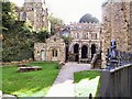
St.Winefride's Chapel and Well, Holywell
Pilgrimage site in N.Wales
Image: © Roger May
Taken: 10 Nov 2001
0.03 miles
2
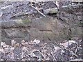
Bench mark alongside the old railway line to Holywell Town - 2
This bench mark is at the very end of a section of wall alongside the former railway line to Holywell. I can only find it indicated on the 1963 O.S. map, and it is not recorded on the modern O.S. database. See also Image]
Image: © John S Turner
Taken: 8 Feb 2011
0.05 miles
3
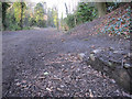
The track bed of the former Holywell Town railway - 2
Looking north along the old trackbed of the railway between Holywell Junction and Holywell Town. The track is now a popular walking route linking Greenfield Heritage Park with Holywell. On the right there is a bench mark very close to the ground - Image
Image: © John S Turner
Taken: 8 Feb 2011
0.05 miles
4
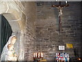
The Catholic chapel building, St. Winefride's Well, Holywell
The interior walls are covered in graffiti in the form of people's names.
Image: © Jeremy Bolwell
Taken: 20 Jun 2010
0.05 miles
5
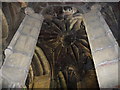
The vaulted ceiling of St. Winefride's Well, Holywell
The ancient medieval ceiling is very evocative.
Image: © Jeremy Bolwell
Taken: 20 Jun 2010
0.05 miles
6

New Road, Holywell
Looking down New Road with the Talacre Arms, advertising B&B with evening meal, on the left.
Image: © Stephen McKay
Taken: Unknown
0.05 miles
7
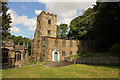
St.James' church
Grade II* listed 14th century parish church, largely rebuilt 1769-70 inevitably linked with St.Winefride's well
Image: © Richard Croft
Taken: 15 Aug 2014
0.05 miles
8
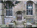
The entrance to St Winefride's Chapel/Capel Gwenffrewi
A view of the entrance and south face of the chapel alongside the footpath to St James' church.
Image: © John S Turner
Taken: 12 Feb 2011
0.06 miles
9
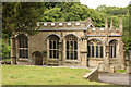
St.Winefride's Well Chapel
Grade I listed and scheduled ancient monument, late Perpendicular well chapel, built c1500-1510 by the benefaction of Lady Margaret, Countess of Richmond mother of Henry VII who died in 1509.
Image: © Richard Croft
Taken: 15 Aug 2014
0.06 miles
10

St Winefride's Chapel
View from south in 1980.
Image: © Sandy Gerrard
Taken: Unknown
0.06 miles