
IMAGES TAKEN NEAR TO
Englefield Road, HOLYWELL, CH8 7JU
Introduction
This page details the photographs taken nearby to Englefield Road, CH8 7JU by members of the Geograph project.
The Geograph project started in 2005 with the aim of publishing, organising and preserving representative images for every square kilometre of Great Britain, Ireland and the Isle of Man.

There are currently over 7.5m images from over14,400 individuals and you can help contribute to the project by visiting https://www.geograph.org.uk
Image Map
Images are licensed for reuse under creativecommons.org/licenses/by-sa/2.0
Notes
- Clicking on the map will re-center to the selected point.
- The higher the marker number, the further away the image location is from the centre of the postcode.
Image Listing (123 Images Found)
Images are licensed for reuse under creativecommons.org/licenses/by-sa/2.0
Image
Details
Distance
1
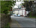
Houses along the A548 Mostyn Road at Greenfield/Maes-Glas
Image: © Mat Fascione
Taken: 15 Apr 2019
0.06 miles
2
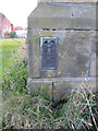
Flush bracket S6273 on Holy Trinity church, Greenfield
This Ordnance Survey flush bracket is on the north-east corner of the church, north face. See also Image]
Image: © John S Turner
Taken: 12 Feb 2011
0.08 miles
3
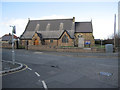
Holy Trinity, Greenfield
Looking across Basingwerk Avenue towards Holy Trinity church. The church was licensed for worship on the 18th October 1871, the chancel and vestry were added in 1910/1911, and the church was consecrated on the 25th April 1911.
Image: © John S Turner
Taken: 12 Feb 2011
0.08 miles
4
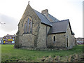
Holy Trinity church, Greenfield
The north-east corner of Holy Trinity church. There is an Ordnance Survey flush bracket on the north-east corner - Image
Image: © John S Turner
Taken: 12 Feb 2011
0.08 miles
5
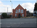
The Alpha Chapel, Greenfield
Looking across the B5121, Greenfield Road, towards the Alpha Chapel, which was established in 1814, but rebuilt in this form in 1907. The Welsh Church Commission reported in 1905 that this English Congregational chapel had 153 "adherents".
The Flintshire Chronicle reported in July 2010 that planning permission had been granted to turn the former chapel into 6 one-bedroom apartments.
Image: © John S Turner
Taken: 12 Feb 2011
0.12 miles
6
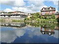
Reflections in a pool
Buildings reflected in a pool near Basingwerk Abbey.
Image: © Philip Halling
Taken: 26 May 2021
0.14 miles
7
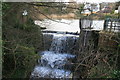
Greenfield Valley Heritage Park - overflow weir
This is on the lowest of several mill ponds arranged down the valley. There are no obvious mill remains associated with this one.
Image: © Chris Allen
Taken: 8 Feb 2014
0.15 miles
8
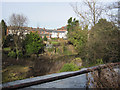
Greenfield Valley Heritage Park - Bottom lake
Looking across the bottom lake in the complex of lakes in the Greenfield Valley Heritage Park. http://www.greenfieldvalley.com/ The houses face onto Greenfield Road.
Image: © John S Turner
Taken: 8 Feb 2011
0.16 miles
9
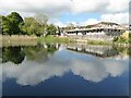
Reflections in a pool
Reflections in a pool near Basingwerk Abbey.
Image: © Philip Halling
Taken: 26 May 2021
0.16 miles
10
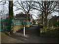
Greenfield Valley Heritage Park
Path down to the main road, the A548, with the Old School on the left and the Farm on the right.
Image: © Eirian Evans
Taken: 26 Jan 2008
0.18 miles