
IMAGES TAKEN NEAR TO
Providence Court, Bagillt Road, HOLYWELL, CH8 7EW
Introduction
This page details the photographs taken nearby to Providence Court, Bagillt Road, CH8 7EW by members of the Geograph project.
The Geograph project started in 2005 with the aim of publishing, organising and preserving representative images for every square kilometre of Great Britain, Ireland and the Isle of Man.

There are currently over 7.5m images from over14,400 individuals and you can help contribute to the project by visiting https://www.geograph.org.uk
Image Map
Images are licensed for reuse under creativecommons.org/licenses/by-sa/2.0
Notes
- Clicking on the map will re-center to the selected point.
- The higher the marker number, the further away the image location is from the centre of the postcode.
Image Listing (136 Images Found)
Images are licensed for reuse under creativecommons.org/licenses/by-sa/2.0
Image
Details
Distance
1
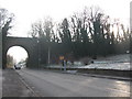
Holywell Branch Railway
Looking southeast along the A548 to the high overbridge which once carried the Holywell branch rail line over the main road. To the right is the start of the footpath along the Greenfield Valley heritage park which now follows the trackbed.
Image: © Phil Williams
Taken: 29 Dec 2005
0.03 miles
2
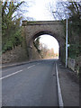
Former railway bridge over the A548 Bagillt Road
This bridge once carried the branch line from Holywell Junction, on the North Wales main line, up the steep gradient to Holywell Town. The track bed to the right of the bridge now forms part of the Greenfield Valley Heritage Park and is a pleasant walk up to Holywell. There is a bench mark on the left hand side of the bridge Image
Image: © John S Turner
Taken: 12 Feb 2011
0.04 miles
3
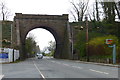
Disused railway bridge across the A548 Bagillt Road
Image: © Mat Fascione
Taken: 15 Apr 2019
0.04 miles
4
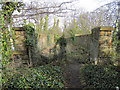
The former Holywell Town branch line bridge
This is the top of the former railway bridge that carried the branch line from Holywell Junction up to Holywell Town. The broken down fencing indicates that it is not a right of way. In the opposite direction, behind the camera, the old trackbed is now a popular walking route up to Holywell. For a view of the bridge from the road below see Image
Image: © John S Turner
Taken: 8 Feb 2011
0.04 miles
5
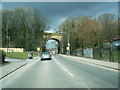
Bagillt road passes under long disused railway bridge
Image: © Colin Pyle
Taken: 2 Apr 2013
0.04 miles
6
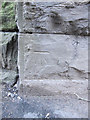
Bench mark on the former Holywell Town branch railway bridge
This bench mark is on the north-east corner of the former railway bridge over the A548, Bagillt Road. The bridge once carried the branch line from Holywell Junction up to Holywell Town. See also Image
Image: © John S Turner
Taken: 12 Feb 2011
0.04 miles
7
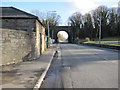
The A548 Bagillt Road at Greenfield
Looking south-east along Bagillt Road opposite the car park for the Greenfield Valley Heritage Park http://www.greenfieldvalley.com/ . The bridge in the distance once carried the steep branch line from Holywell Junction up to Holywell Town.
Image: © John S Turner
Taken: 12 Feb 2011
0.04 miles
8
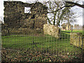
The old farmhouse, Basingwerk Abbey site
According to a 1923 plan held by Cadw (Item reference GTJ02275) this end wall was part of an old farmhouse. Its similarity to the abbey buildings suggests that the stone was take from the adjacent ruins.
Image: © John S Turner
Taken: 8 Feb 2011
0.05 miles
9
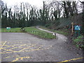
Part of the car park and path at Greenfield Valley Heritage Park
The car park is just off the A548 road and this path gives immediate access to the Heritage Park and all its sites, and ...erm...sights. The big iron wheel is just one of the many industrial remnants salvaged from the site.
Image: © Jeremy Bolwell
Taken: 5 Feb 2012
0.06 miles
10

Footpaths in Greenfield Valley
Looking along the old trackbed of the Holywell Town branch line on the left, which connects with the footpath from the car park on the right. http://www.greenfieldvalley.com/
Image: © John S Turner
Taken: 8 Feb 2011
0.06 miles