
IMAGES TAKEN NEAR TO
Glan Yr Eglwys, MOLD, CH7 6QF
Introduction
This page details the photographs taken nearby to Glan Yr Eglwys, CH7 6QF by members of the Geograph project.
The Geograph project started in 2005 with the aim of publishing, organising and preserving representative images for every square kilometre of Great Britain, Ireland and the Isle of Man.

There are currently over 7.5m images from over14,400 individuals and you can help contribute to the project by visiting https://www.geograph.org.uk
Image Map
Images are licensed for reuse under creativecommons.org/licenses/by-sa/2.0
Notes
- Clicking on the map will re-center to the selected point.
- The higher the marker number, the further away the image location is from the centre of the postcode.
Image Listing (34 Images Found)
Images are licensed for reuse under creativecommons.org/licenses/by-sa/2.0
Image
Details
Distance
1
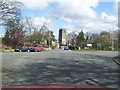
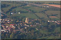
Northop Village and Parish Church
The road crossing from right to left used to be part of the A55 main north Wales highway before it was superseded by the new A55 expressway about half a mile to the north of this view
Image: © David and Rachel Landin
Taken: 8 Apr 2005
0.03 miles
2
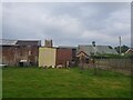
Farm in Northop
Sheep grazing in the village.
Image: © DS Pugh
Taken: 8 Aug 2020
0.06 miles
3
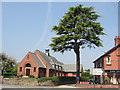
Edith Bankes Memorial Institute, Northop
The Right Honourable Sir John Eldon Bankes G.C.B, erected the Edith Bankes
Memorial Institute in 1932 in memory of his wife.
Image: © Sue Adair
Taken: 8 May 2008
0.07 miles
6
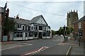
St. Eurgain and St. Peter's Church
Looking along the A5119 Northop Road.
Image: © DS Pugh
Taken: 8 Aug 2020
0.09 miles
7
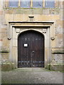
The tower door of St Eurgain and St Peter, Northop
There is a weathered Ordnance Survey bench mark on the grey stone to the right of the door - Image
Image: © John S Turner
Taken: 23 Sep 2017
0.09 miles
8
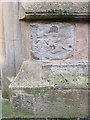
Weathered bench mark on Northop church
This weathered bench mark is just south of the tower door on the church of St Eurgain and St Peter, Northop. See also Image
Image: © John S Turner
Taken: 23 Sep 2017
0.09 miles
9
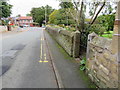
High Street, Northop by the old Smithy
Looking east along the High Street, next to the old Smithy. There is a damaged Ordnance Survey bench mark at the foot of the wall just this side of the gatepost - Image
Image: © John S Turner
Taken: 23 Sep 2017
0.10 miles
10
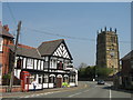
St Eurgain and St Peter's Church & The Red Lion
There has been evidence of a church in Northop since the 6th century. Eurgain, niece of St Asaph founded the church here on a Celtic mound, the Welsh name for Northop, Llaneurgain, means "Holy enclosure of Eurgain". A stone church was erected in the 12th century, with the 98ft tower completed in 1571. This present building was extensively rebuilt in 1840. The Red Lion is presently closed, leaving only one pub (The Boot) open in the village.
Image: © Sue Adair
Taken: 8 May 2008
0.10 miles