IMAGES TAKEN NEAR TO
Penley Road, BUCKLEY, CH7 2BB

Introduction

This page details the photographs taken nearby to Penley Road, CH7 2BB by members of the Geograph project.

The Geograph project started in 2005 with the aim of publishing, organising and preserving representative images for every square kilometre of Great Britain, Ireland and the Isle of Man.

There are currently over 7.5m images from over14,400 individuals and you can help contribute to the project by visiting https://www.geograph.org.uk

Image Map


Images are licensed for reuse under creativecommons.org/licenses/by-sa/2.0
Notes
  • Clicking on the map will re-center to the selected point.
  • The higher the marker number, the further away the image location is from the centre of the postcode.

Image Listing (9 Images Found)

Images are licensed for reuse under creativecommons.org/licenses/by-sa/2.0
Image
Details
Distance
1
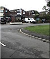
Padeswood Road meets Nant Mawr Road, Buckley
Image: © Eirian Evans Taken: 15 Feb 2008
0.14 miles
2
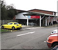
Little Emperor, Buckley
ON Nant mawr Road.
Image: © Eirian Evans Taken: 15 Feb 2008
0.18 miles
3
Buckley War Memorial
Image: © David Dixon Taken: 23 May 2011
0.21 miles
4
Buckley War Memorial
Image: © David Dixon Taken: 23 May 2011
0.21 miles
5
The Precinct Way bus stop and shelter, Buckley
Double yellow lines indicate no parking at any time.
Image: © Jaggery Taken: 12 Oct 2019
0.22 miles
6
Meg's Lane, Buckley
Who was Meg? Her lane leads to Spon Green
Image: © Eirian Evans Taken: 15 Feb 2008
0.23 miles
7
Home Bargains in Buckley
Discount store on the east side of The Precinct Way.
Image: © Jaggery Taken: 12 Oct 2019
0.24 miles
8
Lexham Green Close, Buckley
Cul-de-sac on the south side of the A549 Brunswick Road.
Image: © Jaggery Taken: 12 Oct 2019
0.24 miles
9
Iceland and Bevans name signs, Buckley
Viewed across The Precinct Way in October 2019.
Image: © Jaggery Taken: 12 Oct 2019
0.24 miles