
IMAGES TAKEN NEAR TO
Chester Road, MOLD, CH7 1UJ
Introduction
This page details the photographs taken nearby to Chester Road, CH7 1UJ by members of the Geograph project.
The Geograph project started in 2005 with the aim of publishing, organising and preserving representative images for every square kilometre of Great Britain, Ireland and the Isle of Man.

There are currently over 7.5m images from over14,400 individuals and you can help contribute to the project by visiting https://www.geograph.org.uk
Image Map
Images are licensed for reuse under creativecommons.org/licenses/by-sa/2.0
Notes
- Clicking on the map will re-center to the selected point.
- The higher the marker number, the further away the image location is from the centre of the postcode.
Image Listing (9 Images Found)
Images are licensed for reuse under creativecommons.org/licenses/by-sa/2.0
Image
Details
Distance
1
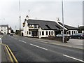
The Queens Head Inn, Chester Road, Mold
Opposite the intersection with Woodlands Road
Image: © Maggie Cox
Taken: 14 Mar 2014
0.04 miles
2
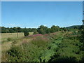
Field Drainage
This drains into the Afon Alun, near Mold
Image: © David Medcalf
Taken: 8 Aug 2005
0.20 miles
3
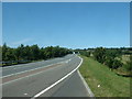
A494 near Mold
Also known as the Mold By-pass road.
Image: © David Medcalf
Taken: 8 Aug 2005
0.22 miles
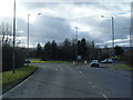
5
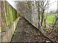
Footpath beside amenity land
From Mold Town Cemetery to Gas Lane
Image: © Maggie Cox
Taken: 14 Mar 2014
0.23 miles
6
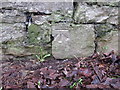
Bench mark on Mold cemetery wall #2
This unrecorded bench mark is on the south east corner of Mold cemetery wall, just north of the corner - see also Image
Image: © John S Turner
Taken: 13 Jan 2016
0.24 miles
7

Ordnance Survey Cut Mark
This OS cut mark can be found on the wall at the SE angle of the cemetery.
Image: © Adrian Dust
Taken: 10 Nov 2025
0.24 miles
8
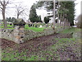
The south east corner of Mold cemetery
Looking towards the south east corner of Mold cemetery. There is an unrecorded Ordnance Survey bench mark on the wall to the right of the corner post - see Image
Image: © John S Turner
Taken: 13 Jan 2016
0.25 miles
9
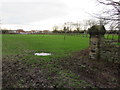
The south east corner of Mold cemetery and a playing field
Looking past the south east corner of Mold cemetery towards the playing field and the extended cemetery. There is an unrecorded Ordnance Survey bench mark on the wall on the right - see Image
Image: © John S Turner
Taken: 13 Jan 2016
0.25 miles