IMAGES TAKEN NEAR TO
Moel Ganol, MOLD, CH7 1TY
Introduction
This page details the photographs taken nearby to Moel Ganol, CH7 1TY by members of the Geograph project.
The Geograph project started in 2005 with the aim of publishing, organising and preserving representative images for every square kilometre of Great Britain, Ireland and the Isle of Man.

There are currently over 7.5m images from over14,400 individuals and you can help contribute to the project by visiting https://www.geograph.org.uk
Image Map
Images are licensed for reuse under creativecommons.org/licenses/by-sa/2.0
Notes
- Clicking on the map will re-center to the selected point.
- The higher the marker number, the further away the image location is from the centre of the postcode.
Image Listing (3 Images Found)
Images are licensed for reuse under creativecommons.org/licenses/by-sa/2.0
Image
Details
Distance
1
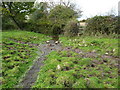
Stream by a stile
On a footpath in a grazing field heading west from Mold
Image: © Maggie Cox
Taken: 10 Nov 2013
0.17 miles
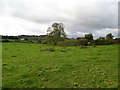
3
Farmland at Bryn Estyn Farm
Looking north.
Image: © David Medcalf
Taken: 29 Aug 2006
0.21 miles