IMAGES TAKEN NEAR TO
Kelsterton, FLINT, CH6 5TH
Introduction
This page details the photographs taken nearby to Kelsterton, CH6 5TH by members of the Geograph project.
The Geograph project started in 2005 with the aim of publishing, organising and preserving representative images for every square kilometre of Great Britain, Ireland and the Isle of Man.

There are currently over 7.5m images from over14,400 individuals and you can help contribute to the project by visiting https://www.geograph.org.uk
Image Map (Loading...)


Getting Data...Please wait
Leaflet Map data © OpenStreetMap
Images are licensed for reuse under creativecommons.org/licenses/by-sa/2.0
Notes
- Clicking on the map will re-center to the selected point.
- The higher the marker number, the further away the image location is from the centre of the postcode.
Image Listing (27 Images Found)
Images are licensed for reuse under creativecommons.org/licenses/by-sa/2.0
Image
Details
Distance
1
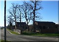
Farmhouse on Kelsterton Road
The road to the left of the farmhouse leads to the cemetery.
Image: © Eirian Evans
Taken: 3 Feb 2012
0.01 miles
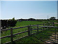
2
Kelsterton Road and Farm
Looking across Kelsterton Road towards farm buildings.
Image: © DS Pugh
Taken: 8 Aug 2020
0.02 miles
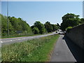
3
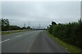
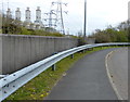
Pavement along Kelsterton Road
Looking along the combined foot and cycle path.
Image: © DS Pugh
Taken: 8 Aug 2020
0.06 miles
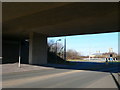
4
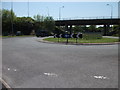
Roundabouts under A548
Access roundabouts to the Flintshire bridge and the Rockcliffe Power Station.
Image: © John Haynes
Taken: 22 May 2012
0.10 miles
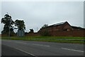
5
Buildings at Kelsterton Farm
Modern buildings on this lowland farm.
Image: © John Haynes
Taken: 22 May 2012
0.11 miles
6
Under the A548
Kelsterton Road underneath the A548, with the power station on the horizon.
Image: © Eirian Evans
Taken: 3 Feb 2012
0.11 miles
8
B5129 i Gei Connah
Realigned road from the A548. When the Flintshire Bridge was built the roads were changed to provide access over the bridge via two roundabouts. Image]
Image: © John Haynes
Taken: 22 May 2012
0.14 miles
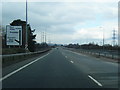
9
Kelsterton Road near Connah's Quay Power Station
Image: © Mat Fascione
Taken: 14 Apr 2019
0.14 miles
10
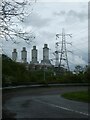
Rockcliffe Hall Gas Fired Power Station and pylons
Image: © David Smith
Taken: 6 May 2023
0.14 miles