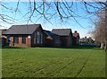
IMAGES TAKEN NEAR TO
Cross Row, Chester Road, FLINT, CH6 5EB
Introduction
This page details the photographs taken nearby to Cross Row, Chester Road, CH6 5EB by members of the Geograph project.
The Geograph project started in 2005 with the aim of publishing, organising and preserving representative images for every square kilometre of Great Britain, Ireland and the Isle of Man.

There are currently over 7.5m images from over14,400 individuals and you can help contribute to the project by visiting https://www.geograph.org.uk
Image Map
Images are licensed for reuse under creativecommons.org/licenses/by-sa/2.0
Notes
- Clicking on the map will re-center to the selected point.
- The higher the marker number, the further away the image location is from the centre of the postcode.
Image Listing (71 Images Found)
Images are licensed for reuse under creativecommons.org/licenses/by-sa/2.0
Image
Details
Distance
1
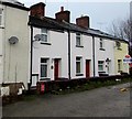
Short row of houses set back from the north side of Chester Road, Flint
The houses are aligned at right angles to the course of Chester Road behind the camera.
Image: © Jaggery
Taken: 16 Jan 2017
0.00 miles
2
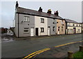
Chester Road houses, Flint
Viewed from the corner of Queens Avenue. The side road on the
left leads to a bridge over the North Wales Coast Line railway.
Image: © Jaggery
Taken: 16 Jan 2017
0.01 miles
3
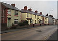
Chester Road houses, Flint
Viewed across the A548 Chester Road. The houses on the far right face the Queens Road junction.
Image: © Jaggery
Taken: 16 Jan 2017
0.02 miles
4
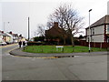
Grassy corner in Flint
On the corner of Chester Road and Kings Avenue.
Image: © Jaggery
Taken: 16 Jan 2017
0.04 miles
5
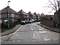
Queens Avenue, Flint
Viewed from Chester Road.
Image: © Jaggery
Taken: 16 Jan 2017
0.04 miles
6
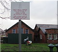
Bilingual notice at the edge of school grounds, Flint
Facing Chester Road, the Welsh/English sign in the grounds of a primary school, Ysgol Croes Atti. http://www.geograph.org.uk/photo/5256901
Image: © Jaggery
Taken: 16 Jan 2017
0.05 miles
7
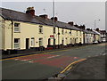
Chester Road houses, Flint
Looking past a speed bump near the corner of Kings Avenue.
The black and white building on the right is the Tradesman's Arms pub. http://www.geograph.org.uk/photo/5257718
Image: © Jaggery
Taken: 16 Jan 2017
0.06 miles
8
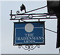
Tradesman's Arms name sign, Flint
Hanging from a wall bracket here. http://www.geograph.org.uk/photo/5257718
Image: © Jaggery
Taken: 16 Jan 2017
0.06 miles
9
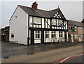
Tradesman's Arms, Flint
Pub at 171 Chester Road.
Image: © Jaggery
Taken: 16 Jan 2017
0.06 miles